state route ranger badge
Tennessee
11

Tennessee State Parks

responsive menu icon
USA Parks
Tennessee
Middle Region
Find A Park
start slideshow
Cedars of Lebanon State Park © Amelia Booth
Nathan Bedford Forrest State Park Cabins © Cindy Kryscio
A look at the rental cabins across the water.
Old Stone Fort State Park Faces in Unlikely Places © Tim Gillahan
I captured this single long exposure shot while I was on a state park adventure on 06/19/2015. Me and my fiance had been hiking most of the day, so we decided to take a break in this spot. I sat and enjoyed the view, reminiscing about life and my future. I noticed that there was some foam floating around in the water. At that point, it was almost sunset, so I set up my camera and tripod and captured some long exposures of this scene, knowing the effect it would give. One thing that I didnt notice at first was the face in the water. In fact, the face is sort of reminiscent of E.T. off of one of my favorite classics. When things like this happen, it brings me peace of mind that photography is my destiny.
Cedars of Lebanon State Park © Amelia Booth
Cherokee National Forest Flame Azalea © Jim Oakley
Round Bald at Roan Mtn
Norris Dam State Park The Old Grist Mill © Maria Trigo
The Grist Mill located in the Norris Dam State Park. Open to Visitors.
Cherokee National Forest Roan Mtn © Jim Oakley
Mockingbird © stateparks.com
Oh Yell © stateparks.com
Campfire and Hotdogs © stateparks.com
Roasting hot dogs over an open fire.
Spring Hike © stateparks.com
Search
Availability
Calendars
Availability Search
Tennessee's Middle Region Parks

3
State Forests
9
State Parks
1
State Wildlife Management Area
1
National Wildlife Refuge
Parks in this region are near these Tennessee Cities (click city name to see parks within 25 miles)
ANTIOCH
NASHVILLE
CLARKSVILLE
HENDERSONVILLE
COLUMBIA
MURFREESBORO
SMYRNA
BRENTWOOD
FRANKLIN
MOUNT JULIET
GALLATIN
LEBANON
MADISON
HERMITAGE
SHELBYVILLE
LA VERGNE
Bledsoe Creek Camping State Park
Off Highway 25, this 164-acre park is situated on the Bledsoe Creek embayment of the U.S. Corps of Engineers Old Hickory Resevoir near the old 1780's settlement of Cairo in Sumner County.........more >
Cedars Of Lebanon State Forest
The Forest is located in the Central Basin of Tennessee in the southern part of Wilson County. The forest is approximately 15 miles east of Nashville. This forest originated from the Resettlement Administration Program in 1935. Tenn. Dept. of Agriculture, Forestry Division assumed responsibility for ........more >
Cedars of Lebanon State Park
Cedars of Lebanon State Park is named for the dense cedar forest that existed in the Biblical lands of Lebanon. The park contains 900 acres which are used for intensive recreation. An additional 8,100 acres are operated by the Parks Division as a natural area and by the Forestry Division as a State Forest.........more >
Cheatham State Wildlife Management Area
........more >
Cross Creeks National Wildlife Refuge
Cross Creeks National Wildlife Refuge Cross Creeks NWR is located four miles east of Dover, in Stewart County, Tennessee and approximately seventy-five miles northwest of Nashville, Tennessee. The refuge was established in 1962 as a result of mitigation proceedings with the U.S. Army Corps of Engineers ........more >
David Crockett State Park
David Crockett State Park was dedicated in May of 1959, in honor of one of Tennessee's most famous native sons.........more >
Dunbar Cave State Park
Dunbar Cave is located 60 minutes northwest of Nashville and about one and a half miles northeast of downtown Clarksville, TN in Montgomery County. Dunbar Cave is the most prominent of several caves located in this designated natural area. In the roomy mouth of the cave, square dances, radio shows, ........more >
Henry Horton State Park
Set in the rolling hills of Middle Tennessee, 1,140-acre Henry Horton State Park is located on the former estate of the late Henry H. Horton, 36th governor of Tennessee. Located on the shores of the historic Duck River, the park provides hours of recreational enjoyment for the day or a weekend getaway ........more >
Lewis State Forest
This area was purchased from the Chancery Court of Lewis County for delinquent taxes in 1933 and became a State Forest in 1936. It is on the Western Highland Rim in central-southwestern Tennessee, in Lewis County. There are no known cultural sites on the forest. There is a demonstration forest road, ........more >
Long Hunter State Park
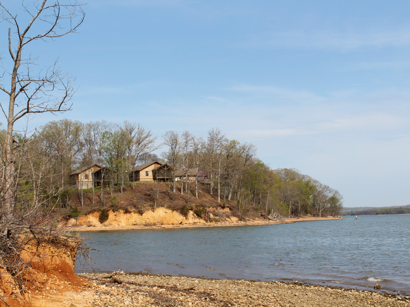
Long Hunter State Park is situated along the shore of J. Percy Priest Lake. It consists of three units Couchville, Baker's Grove, and Bryant Grove. Picnicking, swimming, hiking, backpacking, boating, fishing, nature photography and wildlife observation are among the activities available to park visitors. ........more >
Montgomery Bell State Park
Montgomery Bell State Park is located seven miles east of Dickson in Dickson County. The rolling hills of Dickson County contain a treasure that was considered more precious than gold to the builders of young America. The treasure was iron ore, and it lured men by the hundreds to this area of Middle ........more >
Mousetail Landing State Park
This 1, 247-acre area is located on the east banks of the Tennessee River in the state's picturesque Western valley. Tradition has it that Mousetail Landing received its name during the Civil War period when one of the area's tanning companies caught fire. The exodus of mice fleeing the burning tannery ........more >
Port Royal State Park
Port Royal is an historic park and a day use park. Port Royal State Park is a place of quiet natural beauty. This park is a satellite of Dunbar Cave State Park.........more >
Stewart State Forest
This Forest is located in northwestern Tenn-essee, in south-central Stewart County. State Highway 49 was an old rail bed that connected iron furnaces, that now bisects the forest. It is south of the western boundary of the Cross Creek National Wildlife Refuge. The Forest was acquired from a larger tract ........more >
Visit Another Tennessee Region

state route ranger badge
Tennessee
11

Tennessee State Parks

X