WHITEHALL STATE PARK
This park consists almost entirely of water: the 592 acre Whitehall Reservoir was once used as a source of drinking water. The area offers boating, fishing, a public boat ramp, and hiking trails.
Hotels/Motels
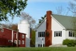
Located on over 100 wooded lakefront acres, overlooking Ashland State Park. Right out our front door you get to truly enjoy the great outdoors. Easy access to trails for hiking, and an area for swimming. Come and enjoy all that Ashland State Park has to offer, and stay at the Warren Center right next door.
6.3 miles from park*
The park offers a boat ramp for public use, allowing visitors to bring their own watercraft. Canoeing and kayaking are popular activities due to the calm waters of Whitehall Reservoir. Motorized boating is also permitted but there's a 12 mph speed limit on the reservoir. Fishing boats can be rented from local vendors around Hopkinton area as well.
Enjoy fishing in a 592-acre reservoir, home to largemouth bass and chain pickerel. Also find yellow perch and sunfish.
Whitehall State Park is located near Ashland, Auburn and Bellingham
Whitehall State Park offers picnic tables and grills, perfect for outdoor meals. Enjoy scenic views of the 592-acre Whitehall Reservoir.
Bicycling is permitted on the park's main roads. However, biking off-road or on hiking trails isn't allowed.
The terrain can be quite hilly and challenging for inexperienced cyclists; caution is advised.
Always wear a helmet when cycling to ensure safety as some areas may have heavy vehicle traffic.
Be aware that during winter months, icy conditions could make bicycling dangerous in this location.
Remember to respect wildlife while riding through their habitat - slow down if animals are present nearby.
Cyclists should also note there aren't any bike rental facilities available within the vicinity of the area.
Birdwatchers can enjoy spotting various species including waterfowl, songbirds and hawks. The park's lake attracts many migratory birds too.
Whitehall State Park is located in east-central Massachusetts.Take Rte. 135 west from Hopkinton Center.


 Share Your Whitehall State Park Photos (click here)