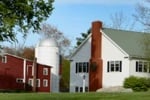
|
State Park Location Maps:
 (click here to zoom and navigate local map)
 (click here to zoom and navigate regional map)
View TOPO Maps!
State Park Photo Gallery:
volunteer positions open
State Park Event Calendar:
volunteer positions open
Nearby Parks: Sutton State Forest Purgatory Chasm State Park Whitehall State Park Quinsicamond State Park Hopkinton State Park Hopkinton State Park Swimming Pool Dam Hopkinton State Park Swimming Pool Reservoir Douglass State Forest Ashland State Park Quaddick State Forest Quaddick State Park Cochituate State Park Wrentham State Forest Great Meadows National Wildlife Refuge
|
|
| State Park Overview: |
 | This 2,600 acre forest offers multiple trail uses including hiking, bicycling, and horseback riding. Hunting is permitted in season. |
| Reviews By Park Visitors: |
 | Be the 1st to Review Upton State Forest. You can rate it, post a comment on it, or do both. |
 | |
 | |
|
| |
|  | Note to Park related businesses: List your vacation cabin, weekend getaway, log cabin rental, romantic cottage, vacation home, resort, hotel, motel, bed and breakfast, country inn, campground, RV park, horseback riding stable, canoe livery, river rafting, outfitting, sporting goods store, guide service, RV rental or any other park related activity, park related attraction or park related service on Google or StateParks.com. (more).... |
|
| Related Links: |
 | Upton State Forest - Upton State Forest Overview. |
| Directions: |
| Upton State Forest is located in the south-eastern part of central Massachusetts.
From east or west: Mass Pike (Rte. I-90) to Rte. I-495 south (Upton exit 21B) right off ramp, go straight 3.5 miles and take right onto Westboro Rd. Forest is 2 miles on the right. |
 |
| |
| |
|