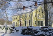
QUADDICK STATE PARK
The area which is now Quaddick State Park was once the site of Thompson's town farm where elderly residents of the village spent their reflective years. Prior to that, it had been a fishing area of the Nipmuck Indians. The cool reservoir water and the sandy beach draw frequent crowds during the warm summer months.
The parcel of land that became Quinnipiac River State Park was first acquired by the State Highway Commission during the construction of the Wilbur Cross Parkway in the 1930s. A little over a decade later when the Parkway was complete the Commission deemed those lands east of the new roadway to be excess property. By the end of 1948 that property was transferred to the State Park and Forest Commission.
But long before the Parkway construction, land in what is now the southern portion of the Park was home to a riverside community that grew up literally right on the banks of the Quinnipiac River. From the 1920s on, the community grew and spread ultimately totaling more than three dozen structures. In those days the summer residents experienced only minor and nuisance flooding. But as upstream development and impervious surface in the watershed expanded, stormwater runoff and flooding events became increasingly dangerous in both velocity and quantity.
By the mid 1970s the decision was made and carried out not to protect the community with flood control structures but to buy out the residents and remove the buildings. That community was within what is now the southerly end of the Park. Today?s main access into the Park, Banton Road, was their access into and out of the community.
In 1960 when the Headquarters of the 2nd Company of the Connecticut Horse Guard was searching for a permanent home these park lands were under consideration. But the same limiting factors that forced the end of the Banton Street community made the property unsuitable for the several dozen horses of the Guard which ultimately settled in Newtown.
Because of its southerly location in its watershed and its proximity to south central Connecticut?s vast transportation network, the park was often asked to compromise its integrity for a variety of rights of way. Fortunately as time passed the value of open space in combination with water quality and floodplain protection rendered applications for this type of proposal less and less frequent until today they are nearly non-existent.The park came under the direction of the Department of Environmental Protection when it formed in 1972.
Today: Today Quinnipiac River State Park is accessible for hikers and walkers. The 320 plus acres of forested floodplain embrace nearly six serpentine miles of the Quinnipiac River?s meandering western shoreline. The park?s combination of habitat, location, water availability and forest cover come together to form remarkable wildlife habitat.
Cleaner waters over the years have provided an increased quality of wildlife habitat, although various river segments still lack diversity of sensitive species. Still, a testament to greatly improved water quality of the lower river is the first recorded overwintering, and possible permanent residence, of two bald eagles in the winter of 2006-07. Look for wild turkey and deer, an occasional otter, great blue heron, kingfishers, osprey, owls, and wood duck nests in dead trees.
Four miles of the 24 mile blue blazed Quinnipiac Trail passes through the Park. Sometimes following the river bank, sometimes somewhat upland, the trial leads north/south from Toelles Road (north) to the barred gate access at the abandoned Banton Street (south). Since it is an active floodplain, the forest floor can be seasonally muddy and the river?s many cutoff meanders (oxbows) inundated.
Connecticut has made state parks, forests, trails, historic sites and beaches more accessible to our residents so they can enjoy the many attractions and beauty they offer. Under the Passport to the Parks program, parking fees are now eliminated at Connecticut State Parks for those with Connecticut registered vehicles. You can view the
CONNECTICUT PASSPORT TO THE PARKS web page to learn more.
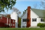
BBs / Inns
A Bed Breakfast in the Quiet Corner of Northeast Connecticut on Route 169, a National Scenic Byway.
14.1 miles from park*


 Share Your Quaddick State Park Photos (click here)