JOHN H. KERR DAM AND RESERVOIR
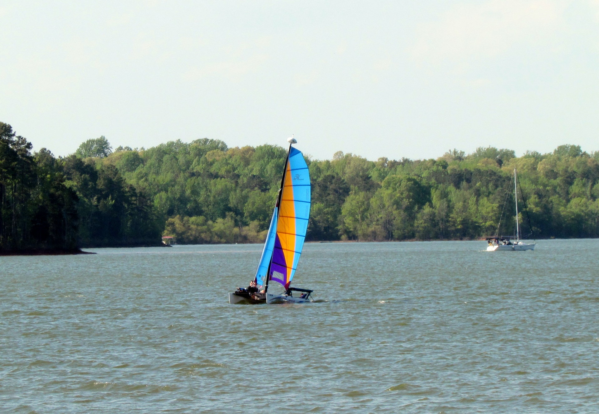
John H. Kerr Dam & Reservoir, also known as Buggs Island Lake, is a 50,000-acre lake extending 39 miles up the Roanoke River along 800 miles of wooded, cove-studded shoreline in Virginia and North Carolina. Visitors enjoy fishing, camping, swimming, boating or just relaxing and enjoying the scenic beauty. There are 30 recreation areas around Kerr Reservoir: campsites, swim beaches, picnic areas, hiking, nature trails, marinas all available for public use. There are 26 wildlife management areas on Kerr, totaling over 10,000 acres. In addition to flood control and hydroelectric power, other benefits include fish and wildlife conservation, recreation, forest management, and water supply.
 Buffalo Park and Campground
Buffalo Park is a small day use and campground park, located on John H. Kerr Reservoir. The campground is open May 1 - September 30. The Day Use Park is open year-around. Kerr, also known as Buggs Island Lake, is a 50,000-acre lake that extends 39 miles up the wooded, cove-studded shoreline of the Roanoke River in Virginia and North Carolina. Kerr Reservoir
....moreLongwood Park Longwood Park is located on John H. Kerr Reservoir, a 50,000-acre lake that extends 39 miles up the wooded, cove-studded shoreline of the Roanoke River in Virginia and North Carolina.
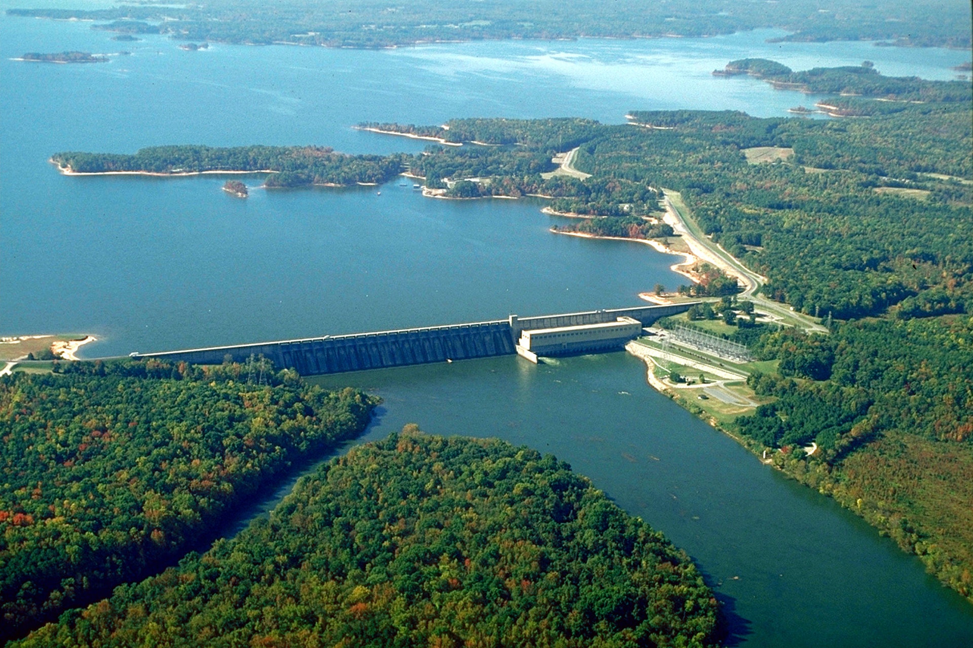
Kerr Reservoir, also known as Buggs Island Lake, was created with the construction of the John H. Kerr Dam in 1952. Its 800 miles of wooded shoreline stretch across six
....more North Bend Park North Bend Park is located on John H. Kerr Reservoir, a 50,000-acre lake that extends 39 miles up the wooded, cove-studded shoreline of the Roanoke River in Virginia and North Carolina. North Bend is the largest park on Kerr Lake and is located at Kerr Dam and the Corps Visitor Assistance Center.
Kerr Reservoir, also known as Buggs Island Lake, was
....more Rudds Creek Campground Rudds Creek Park is located on John H. Kerr Reservoir, a 50,000-acre lake that extends 39 miles up the wooded, cove-studded shoreline of the Roanoke River in Virginia and North Carolina. Rudd's Creek Campground is open April 1 - October 31. The Day Use Park, located across Hwy 58, is open year-around.
Kerr Reservoir, also known as Buggs Island Lake,
....more


 Share Your John H. Kerr Dam and Reservoir Photos (click here)
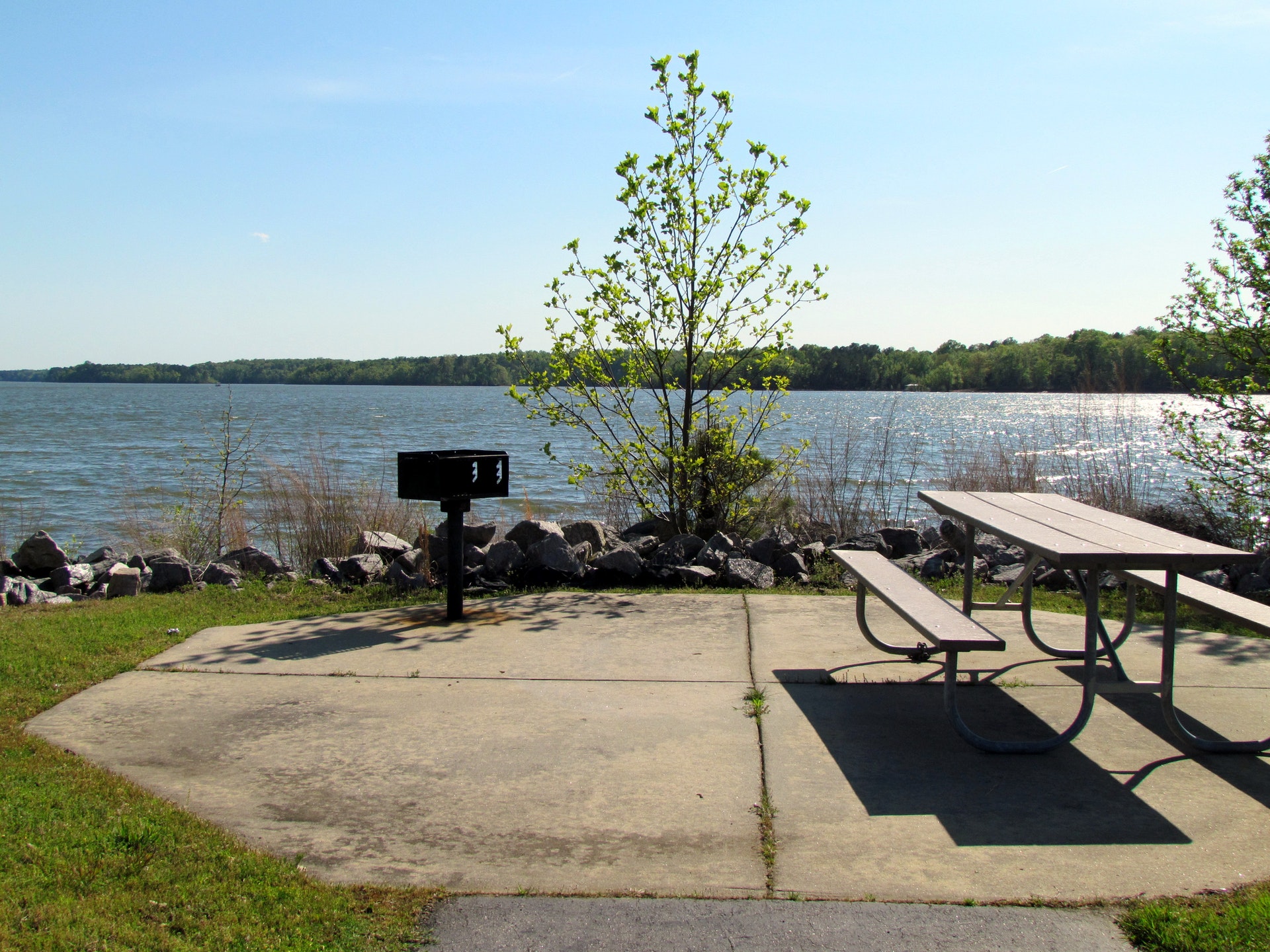