BRIDGEPORT STATE PARK
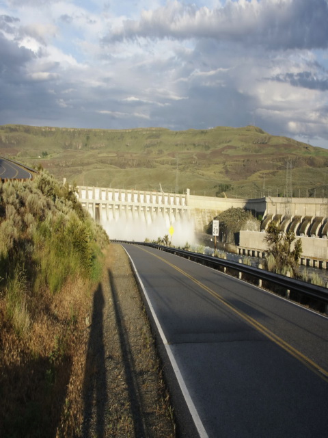
Bridgeport State Park is a 622-acre camping park with 7,500 feet of freshwater shoreline on Rufus Woods Lake. Set directly behind Chief Joseph Dam, this lake is actually a segment of the Columbia River. The park provides 18 acres of lawn and some shade in the midst of a desert terrain. Haystacks, unusual volcanic formations resembling their name, are the park's most striking feature. Located behind Chief Joseph Dam, Bridgeport State Park provides lake, lawn and shade in the midst of a desert terrain. Haystacks, unusual large volcanic formations, are the park's most unique feature. Interpretative programs are offered seasonally on many topics.
A park plaque honors Mr. Ralph Van Slyke who, with the most common garden tools, cut a park in the valley above Chief Joseph Dam in the early 1960s. Van Slyke was a retired employee of the U.S. Army Corps of Engineers.
The park was named for the town of Bridgeport, which from 1881 to 1889 was known as Westfield. In 1889, Mr. J. Covert, a citizen of Bridgeport, Connecticut, came west to survey a railroad route and renamed Westfield after his hometown.
The park was created as part of a cooperative agreement between Washington State Parks and the U.S. Army Corps of Engineers. The Corps is involved in park-building because of an operating agreement for dams which requires the corps to rebuild recreation areas.
A Discover Pass is required for vehicle access to Washington state parks for day use. For more information about the Discover Pass and exemptions, please visit the
Discover Pass web page.
The park provides 14 tent spaces, 20 utility spaces, one dump station, two restrooms both ADA and two showers. Maximum site length is 45 feet. Since the park is heavily used, mid-week is the recommended time to locate a vacant campsite. The campground is situated on a lawn with many shade trees. Most facilities are modern.
The park offers a group camp that accommodates 20 to 72 people.
Located in Okanogan County on Columbia River, Bridgeport provides two watercraft launches and 240 feet of dock.
The lake is abundant in rainbow trout, silvers and walleye. Fishing is open year round. Most fishing is by boat. Shore fishing requires a Colville Tribe fishing license in addition to a state license if fishing off of state park property. Colville Tribe fishing licenses can be purchased at the park or in the cities of Bridgeport or Brewster.


 Share Your Bridgeport State Park Photos (click here)
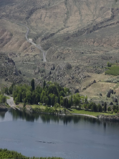