State Parks .com
USA Washington Columbia National Wildlife Refuge


© Carly sue Hammer

VIEW PHOTO GALLERY


Facilities and Activities:
Day-UseFishingyes
 Huntingyes
 Hiking Trail, milesyes
 Picnickingyes


National Park Location Maps:
Local area map for Columbia National Wildlife Refuge location
(click here to zoom and navigate local map)

State of Washington map showing Columbia National Wildlife Refuge location
(click here to zoom and navigate regional map)


View TOPO Maps!

Get directions to this park:
Town and state
OR
zip code

Google™ Maps opens in a new window


National Park Photo Gallery:
   volunteer positions open


National Park Event Calendar:
   volunteer positions open


© Melody Wilson

VIEW PHOTO GALLERY


Nearby Parks:
 Saddle Mountain National Wildlife Refuge
 Potholes State Park


National Park Contact Information:
Columbia National Wildlife Refuge
U.S. Fish and Wildlife Service
Othello, 99344
Adopt-A-Park Contacts:
Yogi's Helper: volunteer positions open
Nature Programs: volunteer positions open
Photography: volunteer positions open
National Park Overview:
The Columbia Basin is on the Pacific Flyway, a major waterfowl migration route, and the many acres of wetlands within the <A HREF="http://www.usbr.gov/dataweb/html/columbia.html">Columbia Basin Project</a> area are used by numerous species. Operating hours: 7:00a.m. - 4:30p.m. Monday through Thursday and 7:00a.m. - 3:30p.m. Friday. Open during daylight hours. Refuge waters include 145 acres of ponds, 841 acres of lakes, and 17.8 miles of streams. Available species include rainbow trout, cutthroat trout, brown trout, largemouth bass, black crappie, yellow perch, and sunfish.
Nature of the Area:
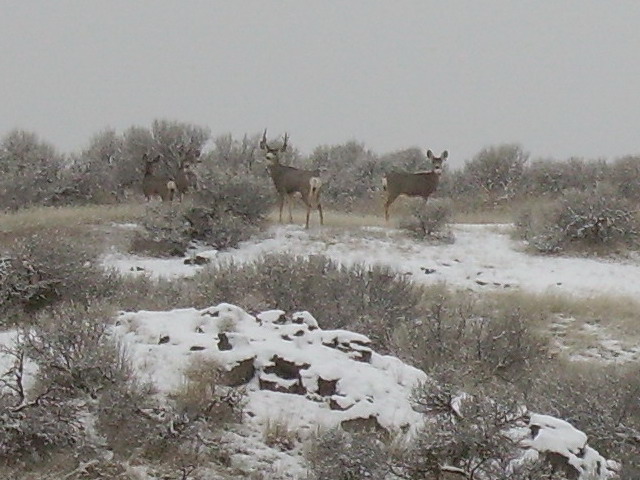
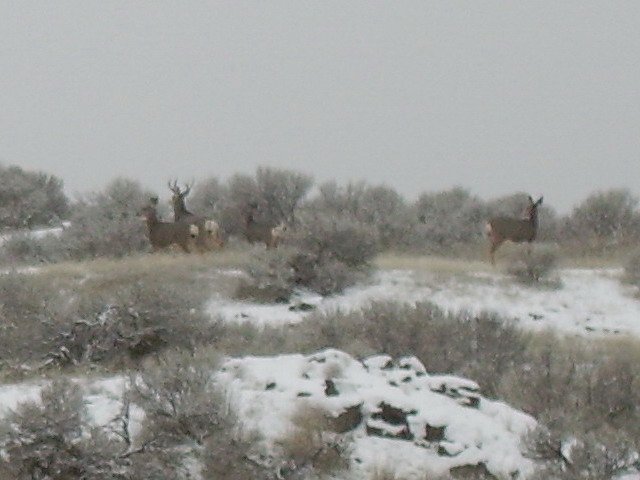
Located in the rain shadow of the Cascade Mountains, Columbia Refuge receives less than 8 inches of annual precipitation, creating an arid, desert environment. The refuge's geological setting is channeled scabland formed when great glacial floods gouged through basalt layers, leaving distinctive canyons or "channels" and numerous rocky buttes and cliffs.

Serious planning to irrigate the Columbia Basin on a large scale began in 1918. The Columbia Basin Project was approved and construction of Grand Coulee Dam began in 1934. In 1951, the first irrigation water began flowing to Columbia Basin farmlands. Columbia Refuge was established in conjunction with the irrigation project in 1944 and has been actively managed since 1955.

With a reliable supply of abundant water, the lakes appeared in former canyons and low spots throughout the refuge and surrounding areas. In many places on the refuge, additional lakes and ponds were created by damming spring and seepage flows. All the present refuge lakes and impoundments are the result, directly or indirectly, of irrigation water. Around the refuge, dryland wheat areas and many acres of sagebrush were soon converted to a wide variety of irrigated crops. Many of these crops, particularly corn, provided abundant food for ducks and geese. The agricultural development, together with the numerous water areas, combined each year to provide ideal feeding and resting areas for many thousands of migrating and wintering waterfowl.
Reviews By Park Visitors:
Be the 1st to Review Columbia National Wildlife Refuge. You can rate it, post a comment on it, or do both.
Visitor rating:no votes yet | Post Your Own Review
Fishing and Hunting:
Fishing:

Fishing is the refuge's most popular activity. Our fishing program provides some spring and fall trout fishing and a fairly good warm water bass, bluegill, whitefish, and walleye catch depending on the season. Lakes are open to motorized, non-motorized boats, and some are closed to depending on the area and the season. Graveled boat ramps and parking areas can be found at Corral, Soda, Blythe, Hutchinson, Teal, and Lower Hampton Lakes. Numerous hunting and fishing map/regulation dispensers are located at most parking areas throughout the refuge.

Hunting:

Hunting for waterfowl, upland birds, deer, and rabbits is allowed in specified seasons and areas. Marsh Unit I is a quality waterfowl hunting area open during the regular State waterfowl season on Wednesday, Saturday, Sunday, and certain holidays. Upland birds may be hunted in the afternoons. Farm Unit 226-227 is a quality waterfowl hunting area by permit only from three designated pit blinds. Hunters are charged a $3.00 application fee for up to three hunt date choices and, if selected, pay a $10.00 blind fee at the honor-fee station on site. Numerous hunting and fishing map/regulation dispensers are located at most parking areas throughout the refuge.
Advertise your park related business
   on stateparks.com
...vacation cabin, weekend getaway, log cabin rental, romantic cottage, vacation home, resort, hotel, motel, bed and breakfast, country inn, campground, RV park, horseback riding stable, canoe livery, river rafting, outfitting, sporting goods store, guide service, RV rental, etc
     read more....
Related Links:
Washington Public Lands: Columbia National Wildlife Refuge - Washington Public Lands: Columbia National Wildlife Refuge ... Write For Us About Washington Public Lands Columbia National Wildlife Refuge Description:The Columbia Basin is on the Pacific ...
Columbia National Wildlife Refuge, Sunday, May 11, 2003 - HOME > JOURNAL > COLUMBIA NATIONAL WILDLIFE REFUGE, MAY 2003 Andrew: Hey, sit on that rock so I can take a photo. Steve ... Forest State Park Columbia National Wildlife Refuge @ NWRS Columbia ...
Tiny Bones - My Field Trips to the Columbia National Wildlife Refuge - 9/23/98 11:58 am bones at U Hampton feeding station. We found these tiny little bones scattered over the top of a rock outcrop above Upper Hampton lake. The bone near the crack in the rock is a...
Bird Checklists of the United States - ... Channeled Scablands of Eastern Washington -- Spokane, WA (Updated 08/95) Columbia National Wildlife Refuge -- Othello, WA Saddle Mountain National Wildlife Refuge -- WA Conboy Lake National ...
http://www.othellosandhillcranefestival.org/ - ... Othello Chamber of Commerce and the Columbia National Wildlife Refuge (U.S. Fish & Wildlife Service). Since the beginning ... have included Columbia National Wildlife Refuge/Potholes area wildlife ...
The Coulee Corridor Scenic Byway - Pathways to Places - Links to Landscapes ... Columbia National Wildlife Refuge provides the sanctuary areas necessary to protect wintering mallard ducks and, to a smaller extent, lesser, and Columbia ...
Directions:
From Othello, Washington, drive 5 miles northwest on McManamon Road, then turn north on Morgan Lake Road. This is the major north/south public road through the heart of the refuge. It starts paved and turns to gravel in approximately 1.5 miles.

This road will take you past McManamon Lake, Crab Creek, Frog Lake, and Upper Crab Creek trailheads and parking areas. Continuing north take the right spur road to Soda Lake Dam boat launch and the Pillar/Widgeon trailhead and parking area.

Leaving the spur road and continuing north to Soda Lake Campground entrance and finally out to O'Sullivan Dam Road. A map of the refuge is available at just about every parking area for further refuge exploration.
USA Washington Columbia National Wildlife Refuge
Visit Rainier Advertise on StateParks.com
    American Dreams Inc. - Logan, Ohio    www.stateparks.com