RIFLE FALLS STATE PARK
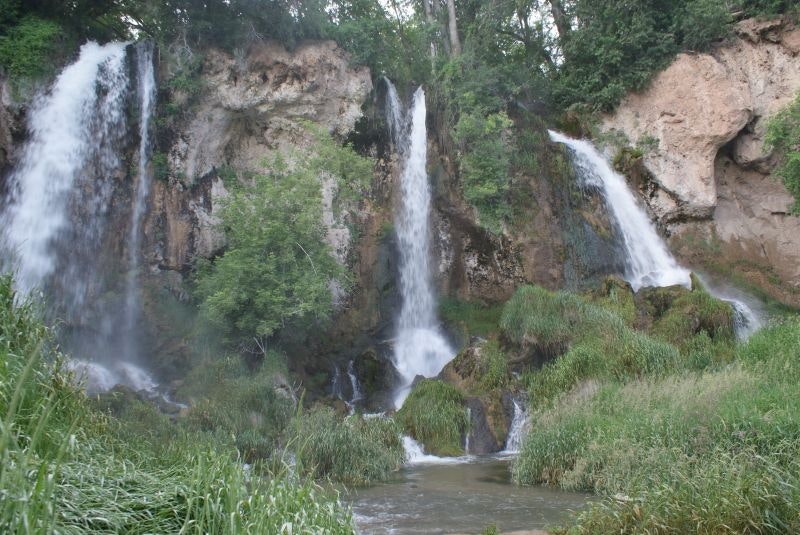
Rifle Falls State Park's lush vegetation and waterfalls have attracted photographers and movie crews from around the country who come to capture the area's unique scenery.
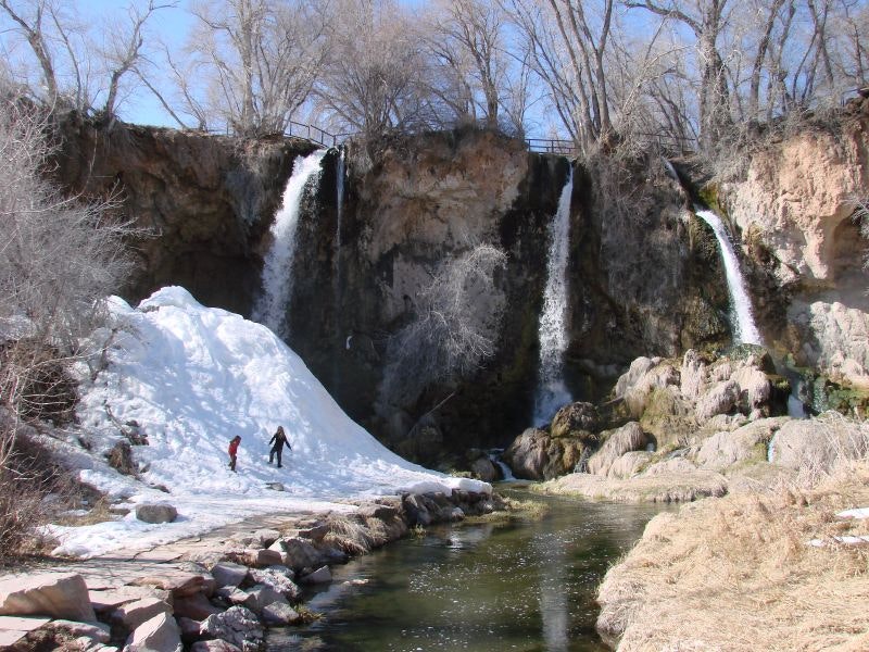
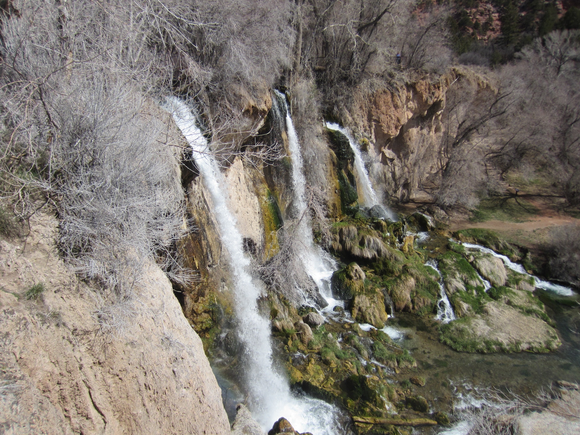
The falls is a lush area of trees and greenery kept moist by the spray of the cascading triple waterfall. Picnicking near the falls is very popular. Mysterious limestone caves beneath the falls entice spelunkers and other curious visitors to explore their dark depths.
Rifle Falls is a VERY busy place during the summer months Many people want to see the beauty that the park has to offer, however, parking is very limited and people are turned away when the parking area is full.
All Colorado State Parks have entrance fees. All vehicles are required to have an entrance pass and some parks have walk-in fees. Visit the
Colorado Park Entrance Pass web page.
Campers get a taste of the tropics when they arrive at Rifle Falls State Park. The greenery comes as a lush, gorgeous surprise to many visitors. A well-groomed hiking trail connects the triple waterfall to the campground. Campsites are available year-round.
Anglers can enjoy fishing in the park's lush surroundings, with opportunities to catch rainbow trout and cutthroat trout.
Rifle Falls State Park is
Rifle Falls State Park offers scenic picnic areas with tables, grills available. Near waterfalls and lush greenery for ambiance.
Bobcat Trail
Permitted uses Foot
Miles paved 0
Miles non-paved 1.0
Total distance 1.0, one way
Usage Low
Degree of difficulty Moderate
Elevation 6,500
ADA accessible No
Comments This is a newly completed trail that links Rifle Falls State Park and Rifle Falls State Fish Hatchery. The trail hikes along East Rifle Creek through boxelder and cottonwood forests, and into open grassy meadows. It provides access to secluded fishing spots on the creek bank, as well as passing several well stocked trout ponds managed by the fish hatchery.
Pets are permitted within the Rifle Fall's boundaries, but are prohibited on the adjacent State Wildlife Area.
Squirrel Trail
Permitted uses Foot
Miles paved 0
Miles non-paved 1.5
Total distance 1.5
Usage Low
Degree of difficulty Moderate
Elevation 6,500
ADA accessible no
Comments First 1/4 mile is ADA. This trail accesses the walk-in tent campsites at Rifle Falls and connects to the Rifle Falls day use parking lot. It meanders along Rifle Creek, passes beneath the canopy of a Gambel Oak forest, climbs to an overlook of the valley below, and then follows along the Grass Valley Canal.
Pets Permitted
Coyote Trail
Permitted uses Foot
Miles paved 0
Miles non-paved 1.5
Total distance 1.5
Usage High
Degree of difficulty Moderate
Elevation 6,500
ADA accessible Yes
Comments ADA to the base of the falls. This trail gives you a breath taking view of the falls from the base and from above, accesses limestone caves bring your flashlights, and winds along Rifle Creek under the canopy of boxelder and cottonwood trees. Trails may be icy during winter.
Pets Permitted


 Share Your Rifle Falls State Park Photos (click here)
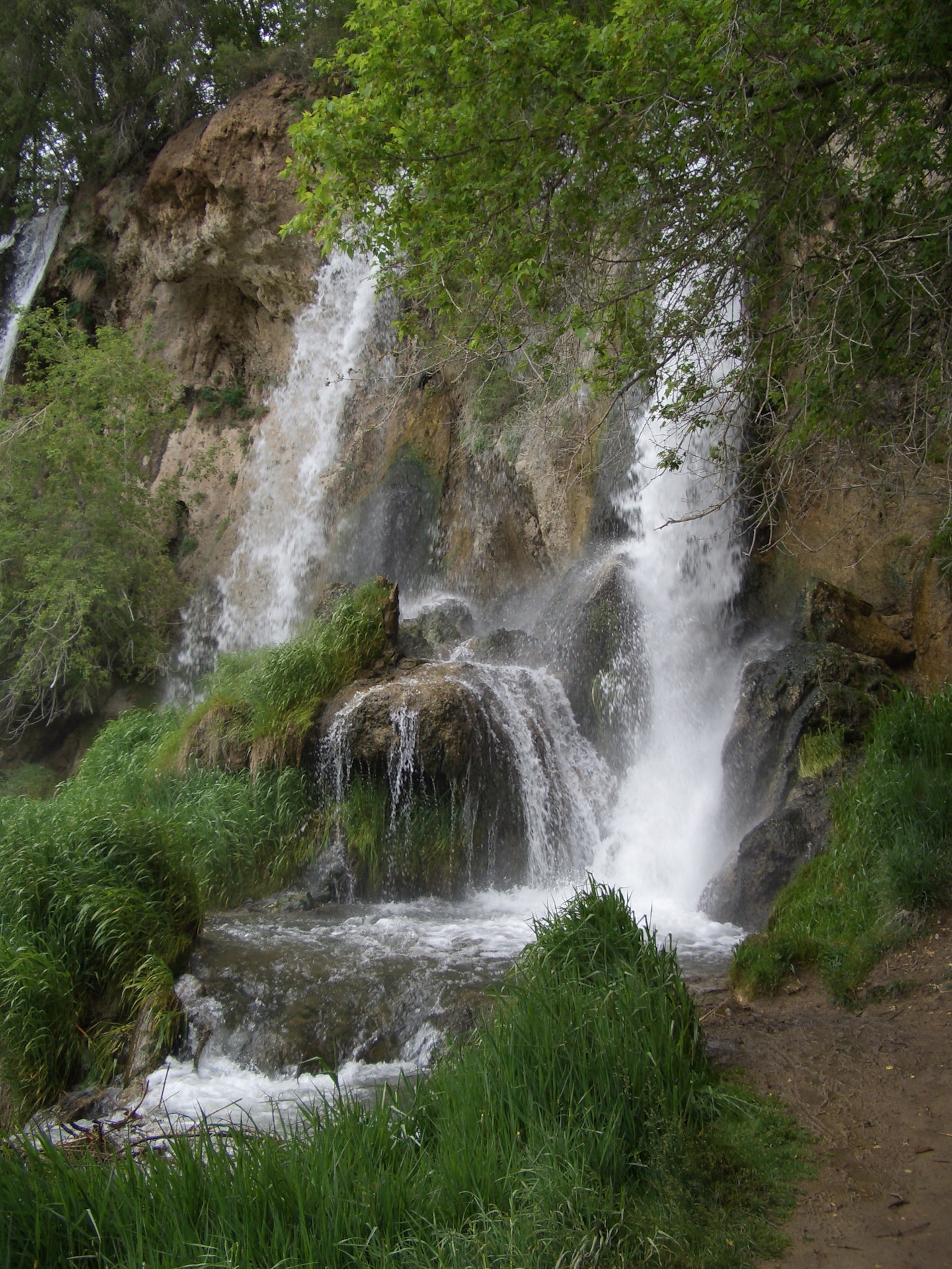