Save
You must be signed in to save park lists.
Your Park Lists
add New List
Add Photo
You must be signed in to add photos.
state route ranger badge
Missouri
62

Missouri State Parks

responsive menu icon
USA Parks
Missouri
Central Region
Lead Mine State Forest
Bluebird © stateparks.com
Campfire and Hotdogs © stateparks.com
Roasting hot dogs over an open fire.
Search
Availability
Calendars
Availability Search
LEAD MINE STATE FOREST
The Lead Mine State Forest is a serene and captivating natural refuge. Spanning over 1,137 acres, this forest showcases the enchanting beauty of the Missouri landscape through its lush woodlands, tranquil lakes, and picturesque terrain. It is a haven for outdoor enthusiasts, offering a plethora of recreational activities such as hiking, fishing, camping, and wildlife observation. As visitors immerse themselves in the forest's scenic trails, they are embraced by the harmonious blend of wildlife, flora, and fauna, exemplifying the state's commitment to preserving its natural wonders.
History of the Area
Lead Mine State Forest is located in the southeastern part of Missouri, specifically in Dent County. The forest gets its name from the historical mining activities that took place in the region, primarily centered around the extraction of lead.

The history of Lead Mine State Forest begins in the early 19th century when lead mining became a significant industry in the area. Missouri was one of the leading producers of lead in the United States at that time. Lead was a valuable resource used for a variety of purposes, including ammunition production during the American Civil War.

The forest was established in 1970 by the Missouri Department of Conservation. It was one of the first areas designated as a state forest in the region. The primary objective of its establishment was to manage the land for multiple uses, including forest product production, wildlife habitat conservation, and recreational opportunities.

Lead Mine State Forest encompasses over 8,000 acres of land, offering a mix of forested areas, open fields, and water bodies. The forest provides habitat for various bird species, white-tailed deer, turkey, and other wildlife.

In addition to its natural resources, Lead Mine State Forest also offers recreational opportunities for visitors. It has several miles of trails that hikers, horseback riders, and mountain bikers can enjoy. Hunting and fishing activities are also permitted within the forest, following the regulations set by the Missouri Department of Conservation.
Nearby Vacation Rentals
Search for a vacation rental


Things To Do in the Area
businesss listing main photo
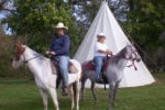
Redbeard's Ranch - Lebanon, MO
Horseback Riding
Redbeard's Ranch is a peaceful, scenic, 295-acre, family-oriented campground in Missouri Ozark hill country with approximately 1 mile of Niangua River frontage. Shaded campsites line the riverfront while the wooded hills and open meadows are ideal for other activities such as horseback riding, hiking, bird-watching, and hunting.
6.7 miles from park*

Visitor Comments, Memories and Reviews
August 29 Favorite place to ride. by adventrider
park review stars; one to five Great trails, with really pretty veiws. Rugged enough to be fun and interesting but not dangerous. Many different trails to ride. We ride on 2 hour trails and up to 5 plus hour trails. Nice camp area too.
April 1 Great horseback riding destination!
park review stars; one to five This is a great place for horseback riding. The trails are always kept up very nice and the camp sites are clean. Plenty of creeks for the horses to get a drink and play around in.
April 25 Wonderful horse back riding trails
park review stars; one to five plenty of watering holes, and pretty views
write a review
Share On

Area Campgrounds
Bennett Spring State Park
26250 Missouri 64A
Lebanon, MO
417-532-4338
Fort Niangua River Resort, Inc.
84 Cat Hollow Trail
Lebanon, MO
417-532-4377
Redbeard's Ranch
30075 Marigold Drive
Lebanon, MO
417-533-7337

Directions
1. Start by getting on I:55 S/I-64 W from Market Street.
2. Continue on I:55 S and take exit 174B to merge onto US-67 S toward Bonne Terre/Farmington.
3. Follow US:67 S for approximately 80 miles until you reach Park Hills.
4. In Park Hills, take a slight right onto MO:B/State Hwy B and continue following it for about 15 miles.
5. Turn left onto MO:C/MO-O/Old Fredericktown Road and drive for another mile or so.

state route ranger badge
Missouri
62

Missouri State Parks

X