HARRISON LAKE STATE PARK
n the midst of endless field of corn and soybeans stands Harrison Lake State Park--a green island of scenic woodlands in a rich agricultural region. Harrison Lake is popular for swimming, fishing, camping and canoeing.
The area comprising Harrison Lake State Park was at one time part of a vast wetland. This mysterious area contained towering trees, soggy black soil and was a haven for the swamp rattlesnake (or massassauga, as it is also known). Very little remains of that once great swamp, but the park still harbors unique natural features associated with wetlands.
Great blue herons and common egrets can be sighted at the lake's shallow western end. Numerous songbirds inhabit the park's meadows and woodlands such as the vesper sparrow, common yellowthroat and brown thrasher. Several species of reptiles and amphibians find the park's habitat suitable. Box turtles, painted turtles, garter snakes, green frogs and American toads are found here. Small mammals such as red fox, raccoon, skunk and the uncommon thirteen-lined ground squirrel are frequently seen.
Originally, Lake Erie was much larger than it is today--stretching from western New York to Fort Wayne, Indiana. The Harrison Lake region was at that time under the waters of Lake Erie. As Lake Erie receded to its present size, the area formerly under water reverted to swamplands. This swamp (120 miles long and 30 to 40 miles wide) became known as the Great Black Swamp due to the color of the soil and dark shade beneath the giant trees.
For many years, the swamp was a tremendous barrier to western settlement. Most settlers avoided the area, traveling around the swamp via Lake Erie to reach southern Michigan. The Ottawa Indians settled only near the well-drained lands beside the Maumee River and its tributaries. The swamp was the last area to be settled in Ohio. It served as a reservation for Indians until they were forced out in 1842. It was not until the development of soil drainage techniques in the 1850s that large numbers of settlers moved here.
Even today, northwestern Ohio remains one of the most sparsely populated regions of the state, although it is one of Ohio's richest agricultural regions.
In 1836, the United States Congress and the Ohio Legislature finally settled a 10-year argument with the state of Michigan as to the location of the Ohio-Michigan border. For years, both states claimed ownership of a strip of land 11 miles wide that extended from the mouth of the Maumee River near Toledo to the Ohio border with Indiana. Today's Ohio-Michigan boundary is the one agreed upon in 1836. Had Congress favored Michigan's claim in that year, Harrison Lake State Park may have become a Michigan State Park!
In 1941, a dam over Mill Creek was completed and Harrison Lake was created. The lake and surrounding area were maintained primarily for hunting and fishing purposes until 1950 when Harrison Lake was established as a state park and development for additional recreational usage began.
Ohio does not have an annual pass and does not charge entrance fees to state parks.
GeneralLand, acres142
Water, acres105
Day-UseFishingyes
Huntingyes
Hiking Trail, miles4
Picnickingyes
Picnic Shelters, #3
Swimming Beach, feet150
Nature Centeryes
Nature Programsyes
BoatingBoating Limits-1
Launch Ramps, #1
CampingPrimitive, #21
Electric Sites, #152
Pets Permittedyes
Flush Toiletsyes
Dumpstationyes
Showersyes
Camper Cabins, #1
Youth Group Camp, capacity100
Rent-A-Yurt, #3
WinterSleddingyes
Cross-Country Skiingyes
Ice Fishingyes
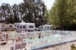
The campground at Harrison Lake has 193 campsites of which 126 have electricity. The campground features showers, flush toilets, a dump station and sites designated for campers with pets. A group camp area with a 50-person capacity is available for organized youth groups on a reservation basis. Three Rent-A-Camp sites consisting of a tent, sheltered picnic table, cooler, cookstove and other equipment can be rented during the summer months by reservation.
A fine swimming beach provides recreation for swimmers and sunbathers.
Non-powered watercraft and boats with electric motors only are permitted on the lake. A launch ramp provides access to the lake.
Good catches of largemouth and smallmouth bass, crappie, bluegill, bullhead catfish, northern pike and carp can be taken from Harrison Lake. A valid Ohio fishing license is required.


 Share Your Harrison Lake State Park Photos (click here)
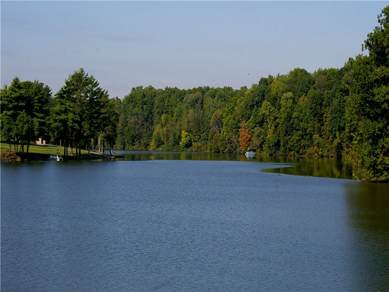