WATSON MILL STATE PARK
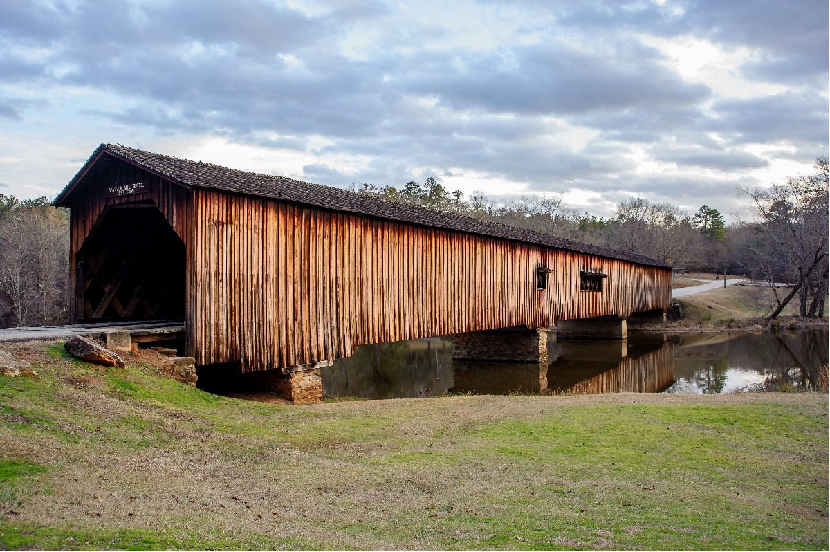
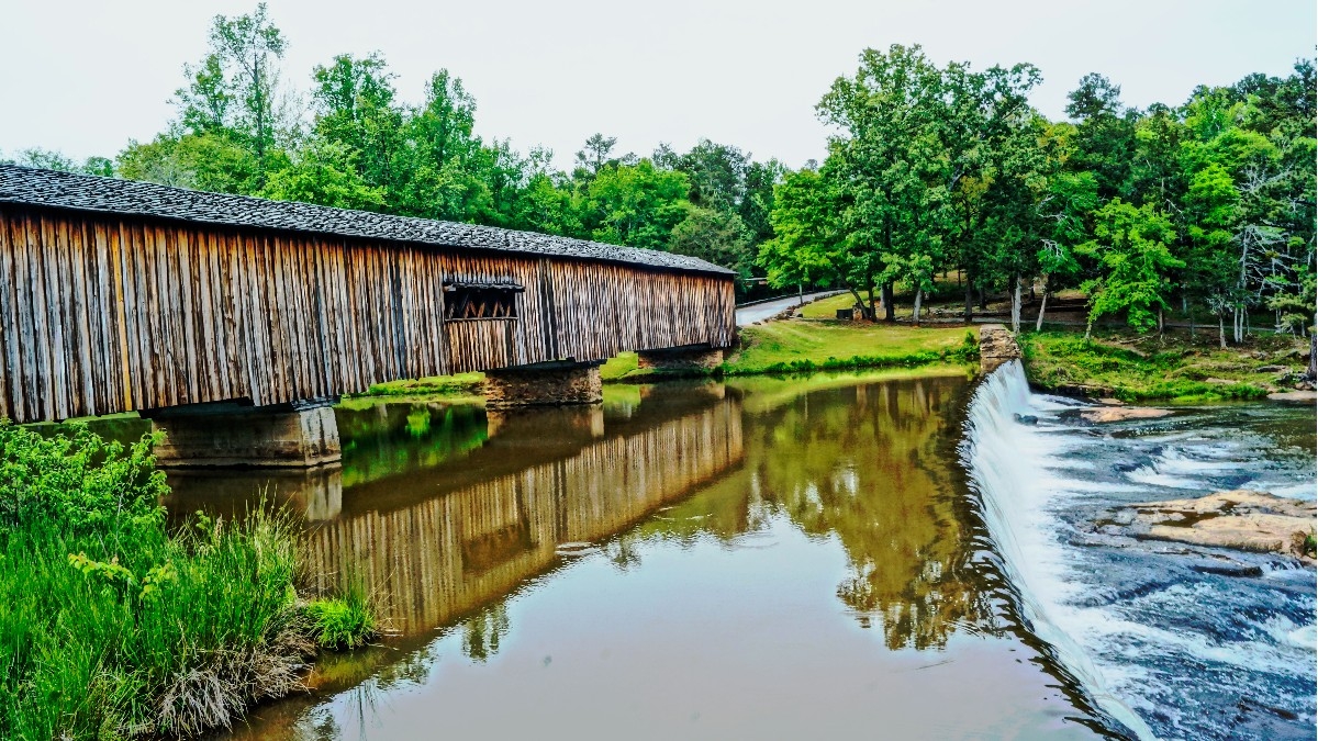
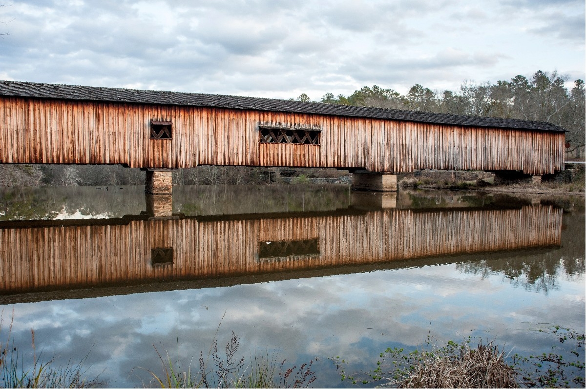
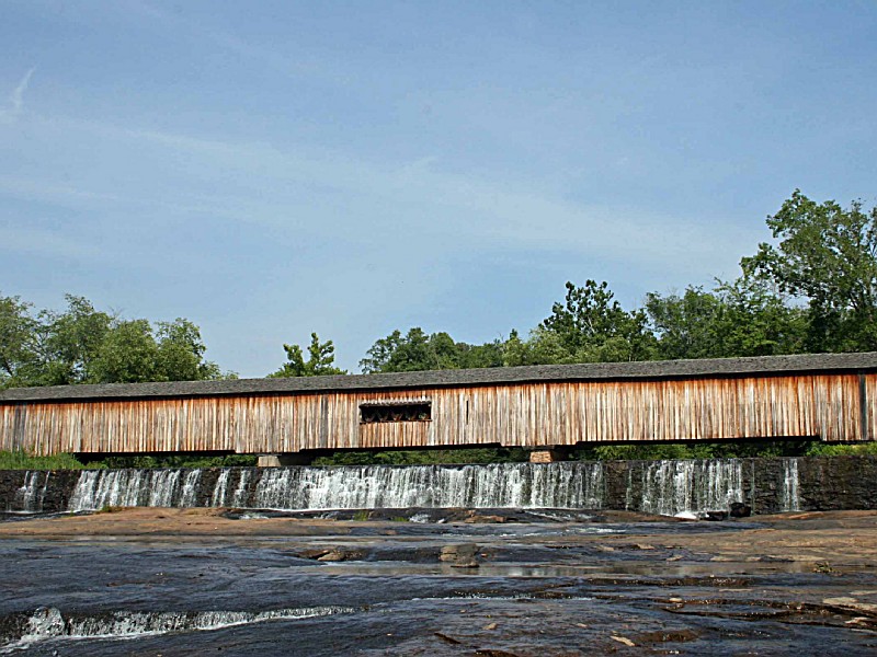
Known as one of the most picturesque state parks in Georgia, Watson Mill Bridge contains the longest covered bridge in the state, spanning 229 feet across the South Fork River. Built in 1885 by Washington (W.W.) King, son of freed slave and famous covered-bridge builder, Horace King, the bridge is supported by a town lattice truss system held firmly together with wooden pins. At one time, Georgia had more than 200 covered bridges; today, less than 20 remain.
The park is an ideal spot for an afternoon picnic or an overnight stay at the campground. Hiking, biking and horseback riding trails allow visitors to enjoy the thick forest along the river or travel into the park?s backcountry. During summer, visitors often play in the cool river shoals just below the bridge.
Enjoy fishing in the serene waters, home to species like largemouth bass and bream. A valid Georgia Fishing License is required.
Watson Mill State Park is located near Athens, Elberton
HORSE TRAILS
Presently, there are 12 miles of horse trails in the park. These trails are designed for equestrians. Bicycles are not allowed on these trails. Dogs are also not allowed on horse trails. These trails go through a variety of environments. While almost unnoticeable, there are remains of old home sites from the 1800s. An agriculture society once occupied this area and, as the years have gone by, nature is taking back what had been altered by man. The state park was established in 1970. However, until the state park acquired additional land in the mid 1990s, private companies were managing portions of the properties for timber production. The overall state park management plan is to help provide sound resource perservation and conservation. However, due to the various uses of the land before it was acquired by the state park, there are numerous environments from ?natural? forested areas to formerly ?timber? managed areas. Along the creeks, large hardwoods with high canopies will be seen. Some of the formerly ?timber? managed areas are now predominately pine forests and a few ?old? abandoned field areas. While the park is full of wildlife, the deer population is truly wild and at the first sign of a person hiking a trail a deer will usually scatter. If you are riding horseback, the deer will generally stand in place for riders to get close-up views (the deer seem to see the trail rider as just another critter rather than a human). Because of the soil types in this area of the country, there are no ?through the stream? trail crossings as streams are all crossed by way of culvert bridges. While there are some grades, most trail riders consider Watson Mill Bridge trails? terrain is not as steep as mountain trails further north nor as flat as the trails further south. This is one of the reasons equestrian trails are so popular at this site. There is something for everyone. At the head of the horse trail system, there is a camping area for equestrians wishing to stay longer than just a day.
Watson Mill State Park offers numerous picnic spots with tables and grills. Covered shelters are available for larger groups.
NATURE TRAIL
The 2 miles of nature trails run along the south side of the South Fork River and Big Clouds Creek. Portions of the trails wander through the historical portions of the park along the old powerhouse sluiceway, also know as a raceway. This man-made waterway channel is about 300 yards long and runs from the old dam just below the covered bridge to a second dam just above the foundation of the old powerhouse. The powerhouse generated electricity for a textile mill 10 miles away in Crawford, GA, for nearly half a century, beginning in 1905. The overlook at the head of this trail affords a view of the covered bridge and shoals below. At this site, the original Watson?s Mill, gone by the end of the 1800s, once sat. The rest of the trails beyond the old powerhouse ruin meander through the woods along the banks of the river and creek and pass by the camping areas.
BIKING & HIKING TRAIL
This six feet wide 2.5-mile loop trail runs along the north side of the South Fork River and is one of the most popular trails for hiking, mountain biking, and jogging. The trail meanders through hardwood and mixed forests and provides one of the best views of the lower shoals of the river. About half way around the loop is an overlook at the edge of what was once a natural beaver pond. Over the years, natural succession has taken place and the former pond area has now become a meadow. It most likely will eventually become part of the forest. Will it ever be a pond again? Only time, Mother Nature and the beavers will tell.
For the mountain biker, this trail is not overly technical as it is designed for beginners and intermediates. There are a few fairly steep grades. The entire trail is under shaded canopy. Whether you hike or bike, you will see a lot of biodiversity in the various types of environments the trail covers.
BEAVER CREEK TRAIL
This six feet wide 1.5-mile loop trail runs up Beaver Creek and over a high ridge back through the hardwood forests on its return. The creek was once the site of several beaver ponds. The beavers left this creek area in the mid 1990s after a period of heavy downpours washed away the beaver dams. They now are most often seen in the river. As time goes on, the beavers may return. But even so, this area is an important wetland habitat. Birding opportunities abound on all trails, but especially on the trails on the north side of the river. This trail is for hiking, biking, and jogging. At the head of where the beaver ponds once began, there is a short rocky section and the entire trail is under shaded canopy.
RIDGE LOOP TRAIL
This six feet wide .75 mile trail begins in sight of the covered bridge where Beaver Creek dumps into the South Fork River. If you look carefully, to the right of the trail as it begins to climb up the ridge, old wheel ruts from ?buggy days? can be seen when a horse and wagon was the mode of transportation. Ferns can now be seen growing in the old ruts. While heavily wooded with big trees providing a shaded canopy, the top of the ridge was once planted in cotton in the late 1800s. Much of the park was once in agricultural use whether planted in cotton or fenced for livestock. While this loop is just under a mile, it is also part of the overall trail system that accommodates hikers, mountain bikers, and joggers.
The park offers a variety of birding opportunities, with over 100 species recorded. Birdwatchers can spot warblers, woodpeckers and hawks in the hardwood forests or along the river corridor. The diverse habitats also attract migratory birds during spring and fall seasons.


 Share Your Watson Mill State Park Photos (click here)
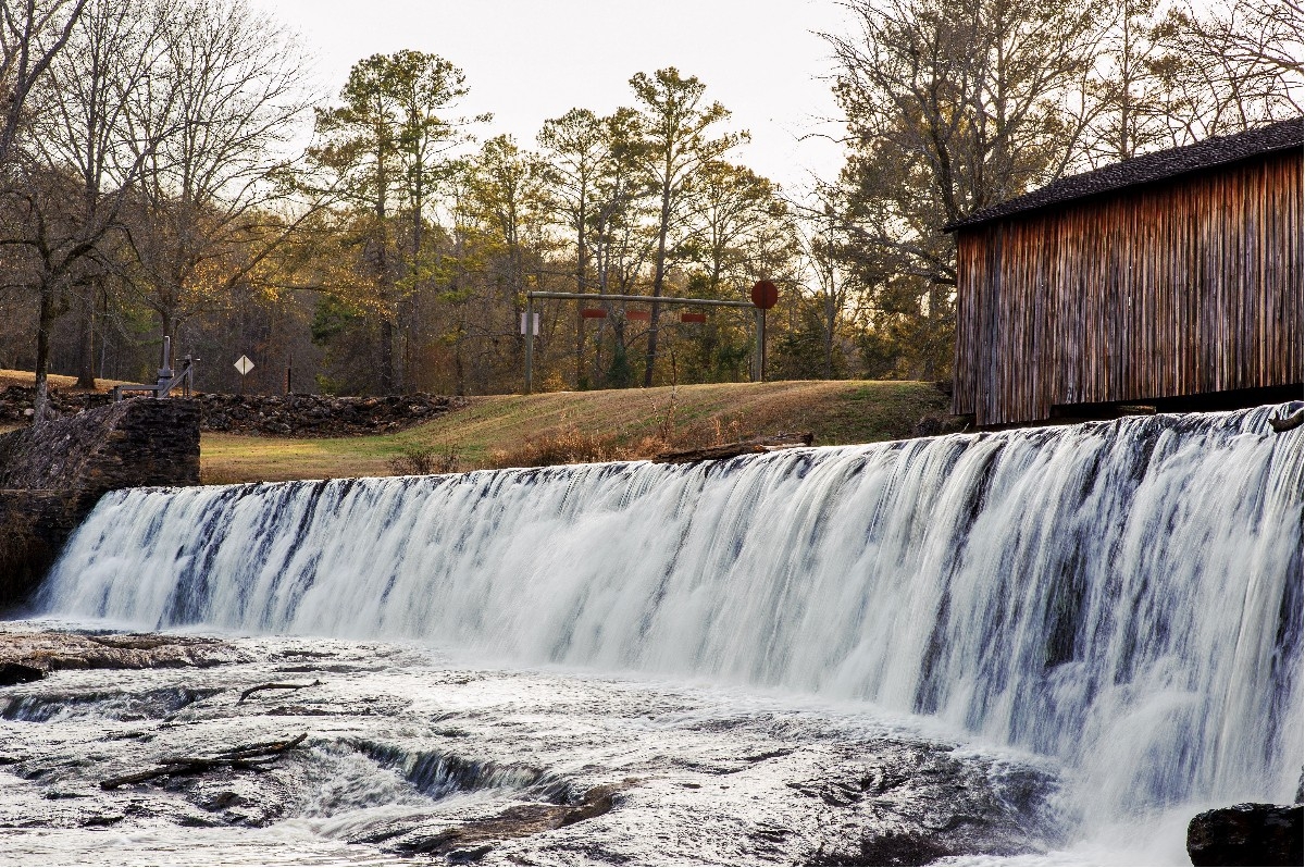