FIELDS SPRING STATE PARK
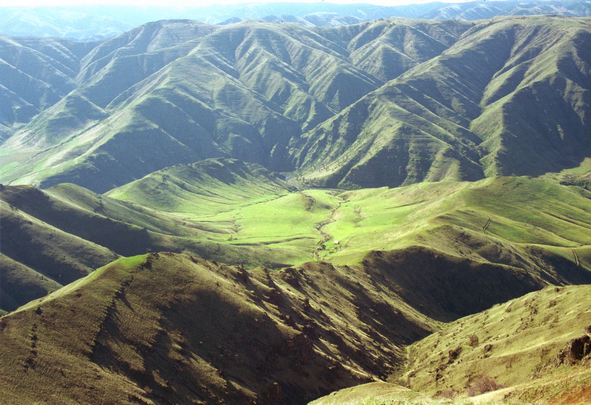
Fields Spring State Park is a 792-acre forested camping park remotely located in the Blue Mountains of Southeastern Washington. A portion of the park sits at a height of 4,500 feet atop Puffer Butte and offers a spectacular view of three states and the Grande Ronde River. This forested park is located in the Blue Mountains with a high elevation of 4,500 feet on top of Puffer Butte. It offers spectacular views of three states and the Grande Ronde River. Spring and summer wildflower displays attract visitors, as do winter sport opportunities.
This volcanically originated park was named after Mr. Fields, an early settler who developed a spring used by himself and neighboring settlers. The park is set along one of the Nez Perce Indian seasonal migration routes.
Puffer Butte was named for Mr. and Mrs. Puffer, homesteaders who every morning climbed the neighboring Peterson Butte to watch for Indians passing in the canyon below. If Indians were spotted, the Puffers moved their livestock to the top of Puffer Butte and left them there until the Indians passed through.
In 1974, 70 percent of the park's Douglas fir and white fir were damaged by a Tussock Moth infestation and had to be removed.
A Discover Pass is required for vehicle access to Washington state parks for day use. For more information about the Discover Pass and exemptions, please visit the
Discover Pass web page.
The park has 20 tent spaces, all of which are suitable for tents or RVs. The park also provides one dump station, two restrooms one ADA and two showers. One kitchen shelter, with electricity, and a wood stove, is in the campground vicinity. All campsites are first-come, first-served. Maximum site length is 30 feet may have limited availability.
Two teepees each sleeps eight may be reserved per night per teepee. To reserve, call the park office at 509 256-3332.


 Share Your Fields Spring State Park Photos (click here)
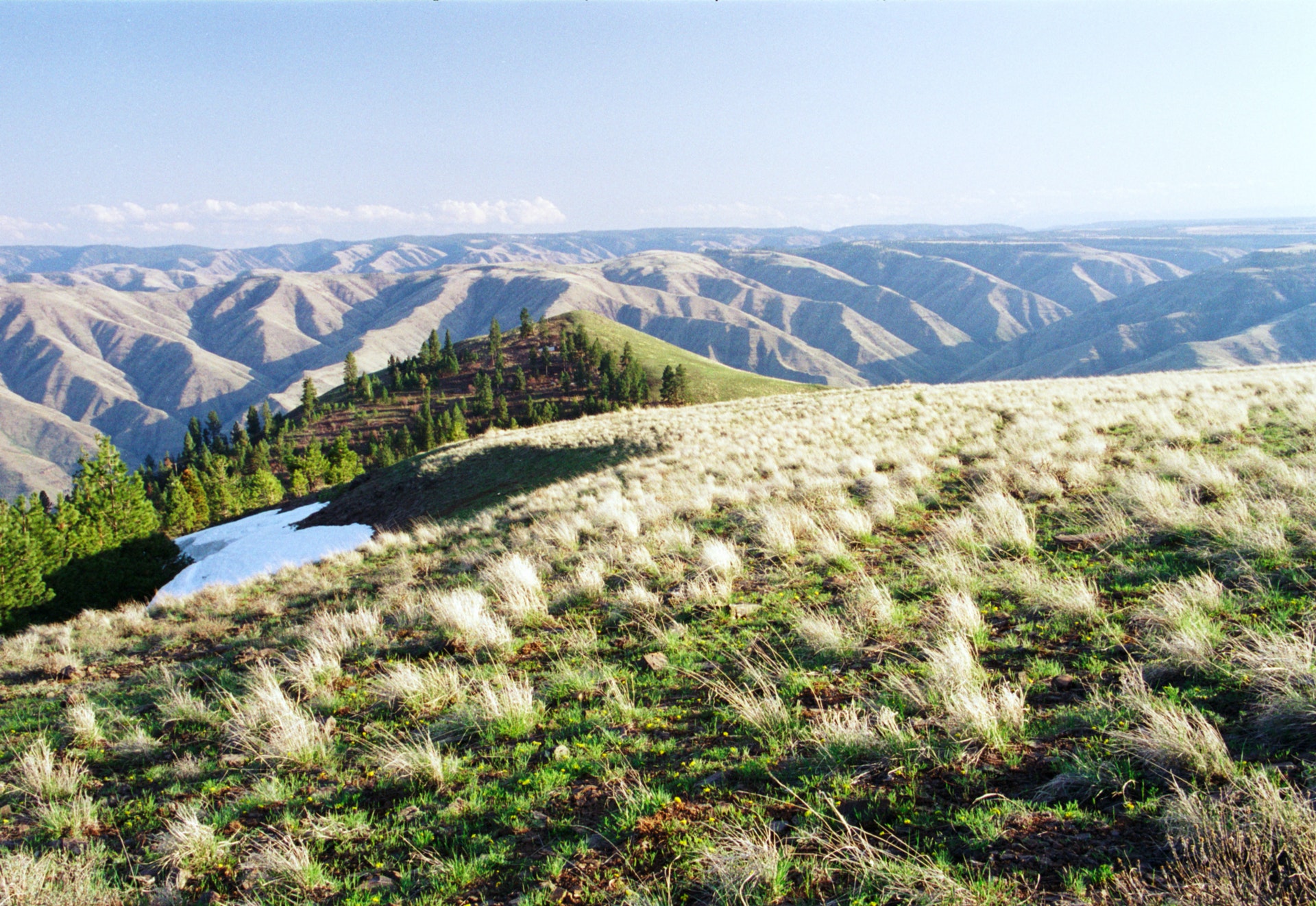