CUMBERLAND ISLAND NATIONAL SEASHORE
Whether you are looking to spend a night with family and friends around a campfire under the moss covered branches of the live oak trees, or looking for the rugged challenges and solitude of the wilderness, you will find it on Cumberland Island National Seashore. The park includes a designated Wilderness area, undeveloped beaches, historic sites, cultural ruins, critical habitat and nesting areas, as well as numerous plant and animal communities. The national seashore also offers a wide variety of camping opportunities.
Cumberland Island offers five campgrounds , which include designated campsites at Sea Camp and Stafford Beach and Wilderness campsites at Hickory Hill, Yankee Paradise and Brickhill Bluff. Camping is only permitted in these five campgrounds. A permit is required to camp in any of these five camping areas. Getting There
Visitors must take a boat to the island. Most visitors arrive via the Cumberland Island Ferry from St. Marys, Georgia see Park Concessioner Services below.
The ferry does not transport automobiles or RVs.
Check the ferry schedule prior to reserving your Cumberland Island National Seashore Camping Permit unless you are traveling by private boat.
The ferry does not operate on Tuesdays and Wednesdays from December through February.
Island Information
Cumberland Island is 18 miles 29 km long and .5 miles .8 km to 3 miles 5 km wide.
Bring your cell phone if possible. Use airplane mode to reserve battery power. There is electricity at the Sea Camp Ranger Station, Sea Camp Campground, and Stafford Beach Campground for recharging devices.
Dial 911 to report emergencies and disturbances.
There are no stores, restaurants or other amenities on the island.
After arriving on the island, campers must hike, walk or bike from the dock to the campgrounds and transport all gear. There is no transporation service. The distance ranges from .5 miles .8 km to Sea Camp to 10.5 miles 17 km to Brickhill Bluff.
Carts of any kind and wheeled coolers are not allowed north of Sea Camp Campground.
Hammocks permitted only with hammock stands. New for 2021. See Superintendent's Compendium
Be prepared for extreme weather, sun exposure, and a variety of insects. Ticks, no see-ums, and mosquitoes are prevalent during summer months protect yourself accordingly.
Understand your limitations the island has no conveniences be prepared for a remote setting and a harsh environment.
Bicycle and Carts
For information on using carts and camping with bicycles visit the Cumberland Island Camping Page
For information on bicycle and cart rentals, as well as transporting your bike to the island visit Cumberland Island Ferry webpage .
Ferry Reservations, Bicycle and Cart Rental, and Tour Reservations - Contact Cumberland Island Ferry at www.cumberlandislandferry.com or call 877 860-6787.
Cumberland Island Ferry passengers must check-in at the Cumberland Island Mainland Visitor Center in Saint Marys at least 30 minutes prior to their ferry departure time https//www.nps.gov/cuis/planyourvisit/be-ready.htm
Campers must deboard the ferry at the Sea Camp Dock not at the Dungeness Dock.
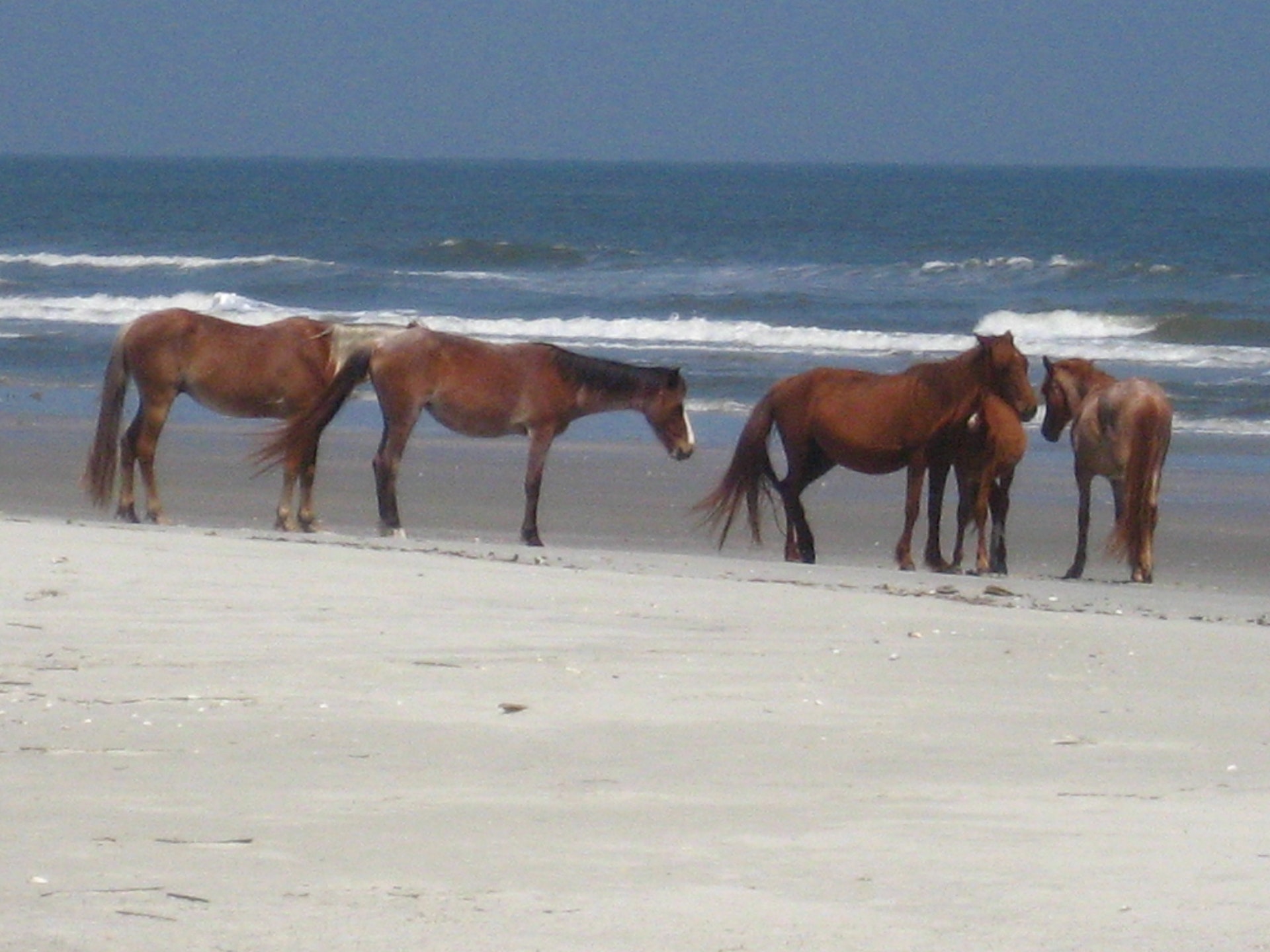
There are over 50 miles of trails and roads as well as 18 miles of beach. Hiking, biking, camping, birdwatching, and beachcombing are popular activities on the island.There are no amenities on the island beyond the restrooms and water fountains. You should bring lunch and water bottles to refill. Be ReadyThe island is home to more than 17 miles of undeveloped beach, a maritime forest of oak hammock and long leaf pine, tidal creeks, and marshland. Visitors can see an abundance of wildlife from deer, turkey, alligators, and bobcats, to snakes, tortoises, lizards, and hundreds of migratory birds.City of St. Marys, GA - St. Marys


 Share Your Cumberland Island National Seashore Photos (click here)
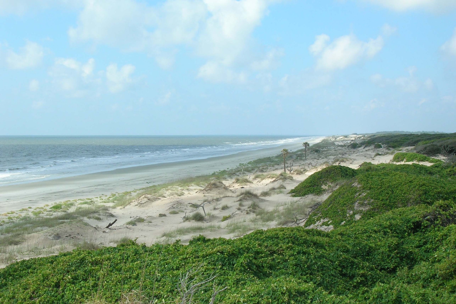