OZARK NATIONAL FOREST
Welcome to the official website of the Ozark-St. Francis National Forests.
The Ozark-St. Francis National Forests are really two separate Forests with many differences. They are distinct in their own topographical, geological, biological, cultural and social differences, yet each makes up a part of the overall National Forest system.
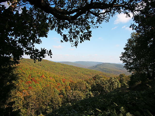
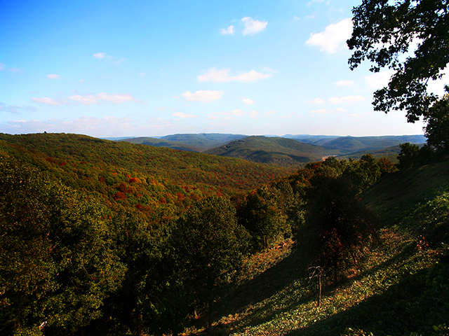
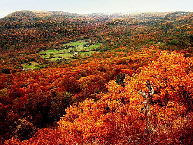
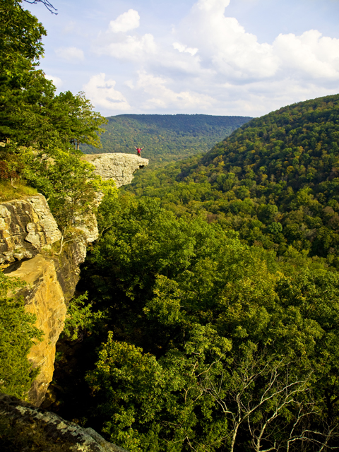
The Ozark National Forest covers 1.2 million acres, mostly in the Ozark mountains of northern Arkansas. You'll find the tallest mountain in the State, Mount Magazine, and an incredible, living underground cave--Blanchard Springs Caverns.
The St. Francis National Forest covers 22,600 acres in eastern Arkansas, one of the smallest and most diverse forests in the country.
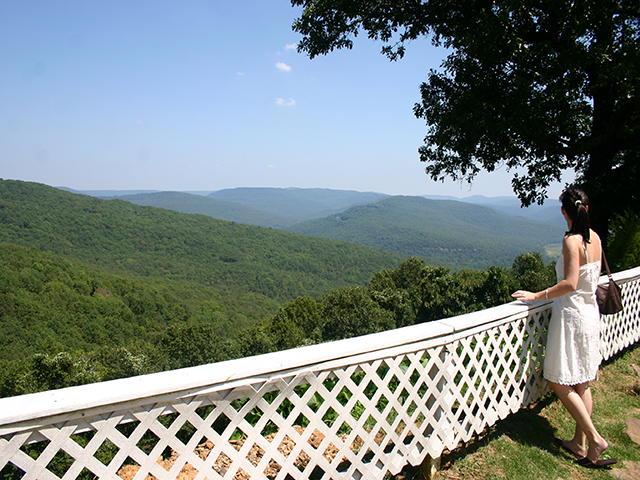
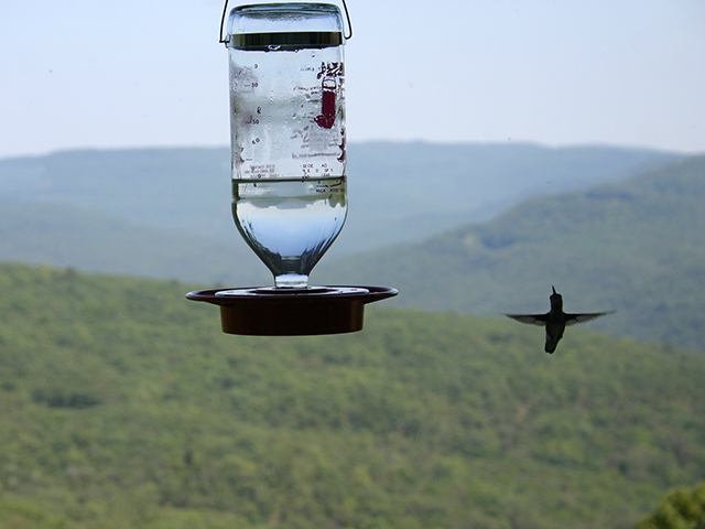
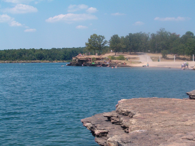
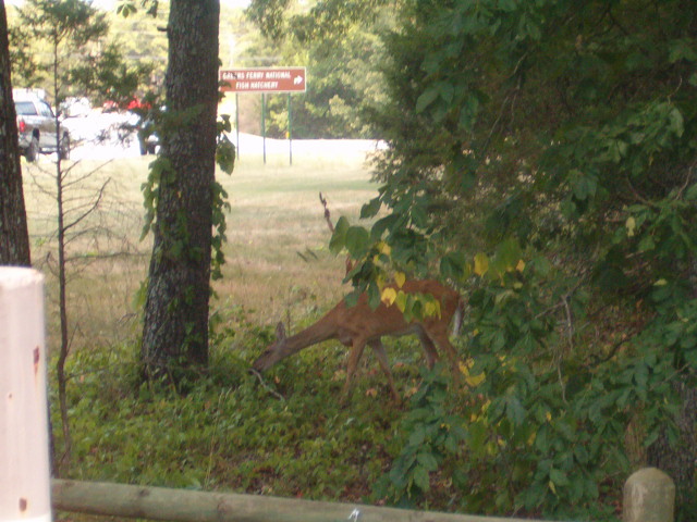
These forests are generously endowed with recreational opportunities for camping, hiking, swimming, fishing, hunting, boating, scenic drives, picnics sites, and opportunities for wildlife viewing also abound.
Step into the past by visiting the 1930's vintage cabins on the Ozark National Forest. Rent a cabin for an evening atop White Rock or beside Lake Wedington.
Lake Wedington
History: During the 1930's local men, employed by the Works Progress Administration (WPA), began building the lake and a recreation area and planting trees under the guidance of the Soil Conservation Service. With native oak from the lake bed and native stone and native skills, the buildings took shape and the lake filled with clear spring water. By 1954, the trees were tall, and the administration of the land was passed to the U. S. Forest Service.
In 1988, after 50 years of use, the park needed major repairs and the WPA cabins had been abandoned. A group of volunteers formed Friends of Lake Wedington to restore the cabins. With the Forest Service they continue to refurbish the buildings, update the facilities, and make the park accessible to all. Lake Wedington Recreation Area is now on the National Register of Historic Places.
Overnight guests can stay in any of the six recently refurbished historic cabins with swimming, playgrounds, paddle boats and canoe rental, volleyball courts, horseshoes, and a snack bar available during the summer. Lake Wedington has a lodge available for larger groups for day use only.
Lake Wedington Recreation Area is now being managed by the University of Arkansas in a unique partnership with the Forest Service. The University can be contacted for information regarding the recreation area and cabin rentals by calling (479) 442-3527 or through their web site at http://policy.uark.edu/lake.
Take Arkansas 16 (paved) west from Fayetteville for 13 miles. Negotiable by camping trailer rigs.
White Rock
History: The three natural stone cabins and lodge on White Rock Mountain were built in the 1930's by the Civilian Conservation Corps (CCC). The CCC was formed during the Great Depression by President Franklin D. Roosevelt.
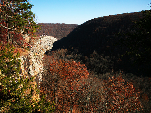
Wind, rain, and natural elements caused the deterioration of the buildings over the years. In 1987, a volunteer group, Friends of White Rock, formed and began a project to renovate the structures. With a lot of hard work, the cabins and lodge were restored in 1991. Once again, visitors to White Rock Mountain are enjoying the scenic views from the cabins. On a clear day you can see for 40 miles over the Ozarks and surrounding area. Caution, there are high bluffs around the mountain top. For your safety, please be careful and keep young children away from the bluff edge!
The cabins can be rented year-round. All three feature stone fireplaces and original furniture. The lodge can accommodate up to 30 people a night. Reservations for the cabins and lodge can be made by calling the concessionaire at (479) 369-4128.
From Mulberry, take Arkansas 215 (paved) north for 15 miles, continue on Forest Service Road 1505 (gravel) for 8 miles, continue on Forest Service Road 1003 (gravel) for 2 1/2 miles.
There are many choice locations available in the national forest campgrounds. Camp along the river or lake, or at one of the mountain camping areas. There are plenty of developed campsites from which to choose your own personal spot in the forest. Several locations have hot showers. Some are year round such as Blanchard Springs Recreation Area, Redding, and Cove Lake, while others are available May-Oct. at Lake Wedington, Shores Lake , Storm Creek, and Long Pool. Day-use areas with cold showers, May-Oct., are Lake Wedington, Horsehead Lake, and Spring Lake. Shores Lake day-use area has hot showers May-Oct. Camping and day-use fees vary. If you are camping at the developed campground, day use is no additional charge.
PRIMITIVE CAMPING:
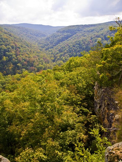
The Ozark National Forest has five wilderness areas totaling 65,826 acres of undisturbed beauty. These wilderness areas were created by the Arkansas Wilderness Act of 1984. The wilderness areas are open for primitive camping, hunting and fishing (in season), hiking, swimming (if available), nature study, and to those seeking solitude.
Please place camps well away from creeks and tributaries. Showers can be locally heavy and occasionally have been known to produce 5 to 10 inches of rain in a few hours. Such storms will cause flooding in the rivers and tributaries of any or all of these wilderness areas.
WILDERNESS AREAS:
Upper Buffalo -- This wilderness area contains 11,094 acres located in Newton County, Arkansas. The area features the headwaters of the Buffalo National River and rugged, steep terrain, deep valleys and forested hills.
Hurricane Creek -- This wilderness area covers 15,177 acres in Newton and Johnson Counties, Arkansas. The wilderness is characterized by upland oak-hickory hardwood forest, sandstone bluffs, and Hurricane Creek, that runs through the middle of the area. The Ozark Highlands Trail, a 165 mile hiking trail, crosses the wilderness area.
Richland Creek -- This wilderness area contains 11,822 acres in Newton and Searcy Counties, Arkansas. In addition to beautiful Richland Creek, which flows through the area, the wilderness also features an oak-hickory forest, abundant wildlife, secluded back-country areas and towering vistas.
East Fork -- This wilderness area contains 10,777 acres located in Pope County, Arkansas. The area is characterized by typical Ozark "hills and hollows" and clear mountain streams. The area is bounded on the west by Arkansas Highway 27, on the north by Forest Service Road 1301, on the east by Forest Service Road 1302.
Leatherwood -- This wilderness area contains 16,956 acres located in Marion, Baxter and Searcy Counties, Arkansas. Steep, rugged terrain characterizes this area with an upland oak-hickory forest. The famous Buffalo National River forms part of its boundary.
Camping fees vary from $4.00 - $10.00 per night per site.
The Ozarks are known for the clear mountain streams, but please filter water before drinking! Beware of stream crossings after heavy rains.
Wilderness Area Camping in any of the five designated Wilderness Areas is welcome. No facilities or campgrounds are available. Water will not be available, so you must pack it in or use a water filtration system. Please sign in at the trailhead to leave information about the direction you are taking and how long you expect to be gone, so Forest personnel can locate you in case of emergency. Use "Leave No Trace" ethics, pack it in pack it out.
Private property borders the roads and trails in various places. Please respect the owners by not trespassing.


 Share Your Ozark National Forest Photos (click here)
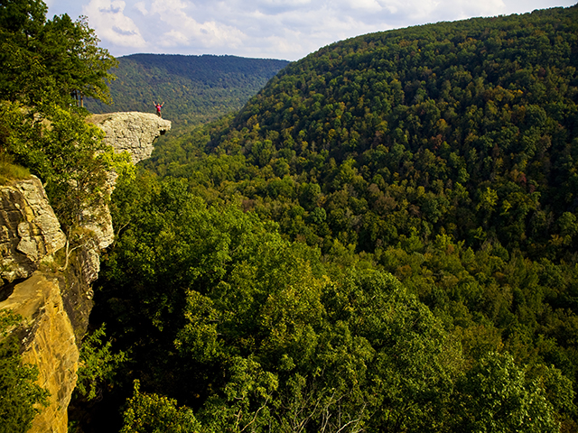