HOLUA CAMPGROUND
HOLUA CAMPGROUNDKula, Hawaii 96790
(lat:20.7399 lon:-156.2184)

There are two primitive wilderness tent areas which are accessible only by trail, Holua and Paliku.
Holua, the wilderness tent area reached by the shortest hike, lies at 6,940 ft 2,115m in the shrubland near Koolau Gap. Holua is 3.7 mi 6 km one way down the Halemauu trail or 7.4 mi one way 12km from the Keoneheehee sliding sands trailhead. Visitors staying at Holua can enjoy day hikes further into the crater. The landscape around Holua supports a native shrubland which colonizes the lava flows.
At 6,380 ft 1,945m, Paliku is on the east end of the wilderness valley at the base of a rain forest cliff. This wilderness tent area is reached via a strenuous 9.3 mi 15km one way hike on the Keoneheehee sliding sands Trail or 10.4 mi 17km one way hike on the Halemauu Trail. Clouds and fog often roll over the top of the cliffs behind Paliku, and rain is common. The extra moisture makes this spot exceptionally cool and lush.
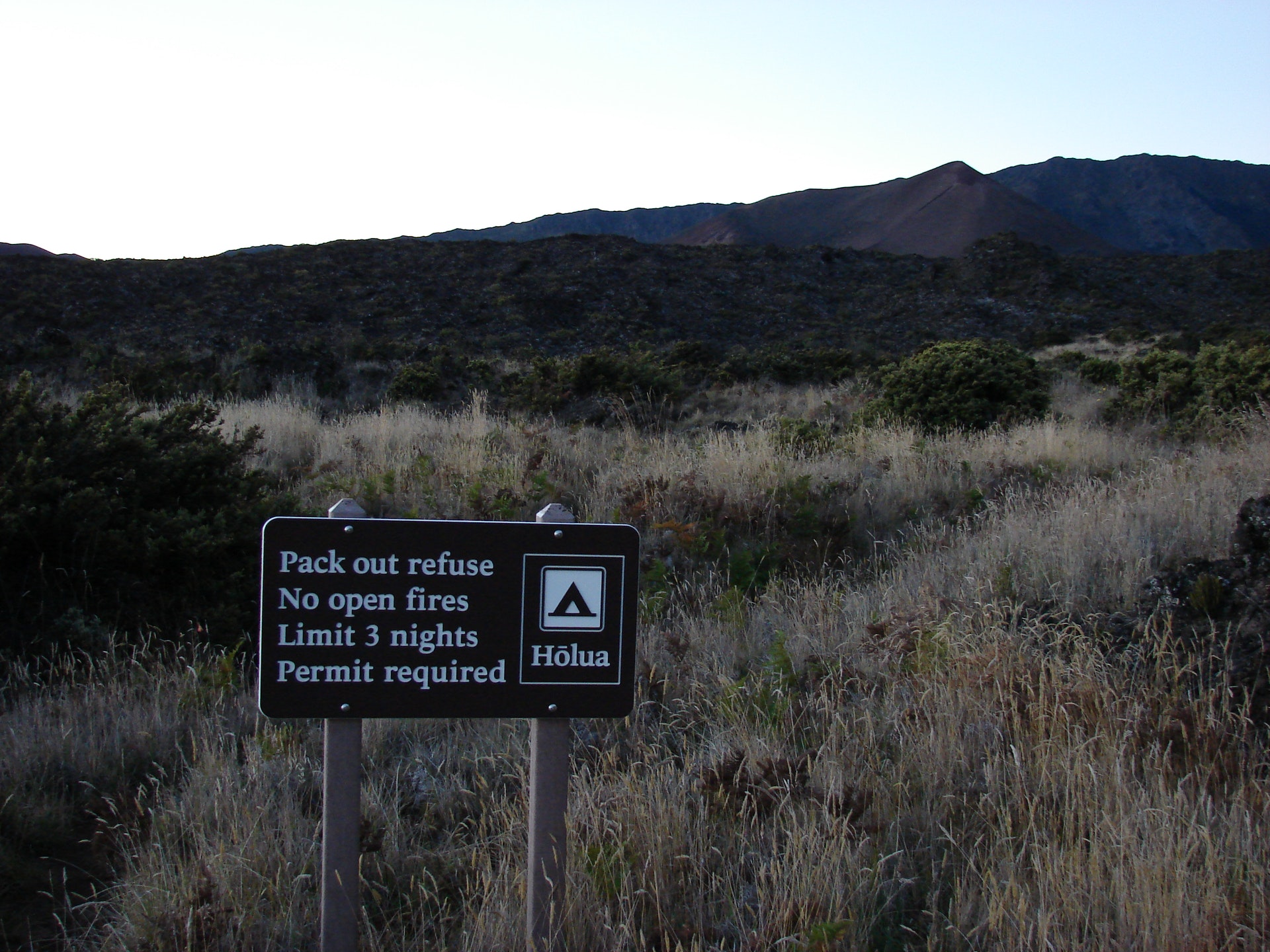
Both wilderness tent areas have 4 designated individual tent sites 5 people, 2 tents maximum and 1 group site 10 people, 4 tents maximum. One pit toilet is located nearby in both wilderness tent areas. A non-potable water spigot is located outside of the wilderness visitor cabins adjacent to the wilderness tent areas.
Sites are located inside Haleakala crater and involve a strenuous hike. Campers should prepare for hot, sunny, cold, wet, and windy conditions as weather can change rapidly. There is no shade or water on the crater floor, and temperatures can vary from 40-70 degrees Fahrenheit during the day and 30-50 degrees Fahrenheit at night, so pack plenty of water, sunscreen, and layers. If it is stormy, winds can exceed 80 miles per hour with temperatures dropping well below freezing.
Hiking trails may be steep. Terrain may include loose cinders and/or rocks. Change in altitude can be from a high of 9,780ft to a low of 6,380ft. Due to the soft sandy nature of the trails, plan on spending twice as much time to hike out as to hike in.
Campsites are located near the wilderness visitor cabins. A wilderness tent permit does not grant access to any wilderness cabin within the crater. Wilderness cabins can be reserved through rec.gov.
Both tent areas are wonderful opportunities for night sky viewing in what's considered one of the quietest natural places on earth Campers may even come across native species such as the Nene Hawaiian goose. Please remember to keep your distance from any wildlife and refrain from freeding them.
From both Holua and Paliku campsites, campers have the option to day hike on trail through the crater. Locations to enjoy from Holua may be the Silversword loop or the loop around Halalii cinder cone. Locations to enjoy from Paliku may be a loop hike toward Kapaloa or toward Kaupo Gap and back. Visit https//www.nps.gov/hale/planyourvisit/maps.htm to plan your day hikes from either campsite. Please stay on designated trails throughout your crater journey and pack out everything with you


 Share Your Holua Campground Photos (click here)
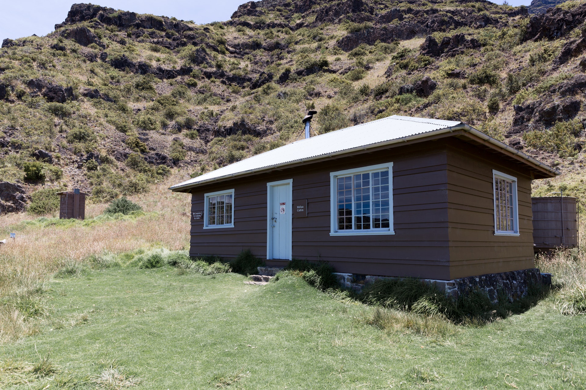