Save
You must be signed in to save park lists.
Your Park Lists
add New List
Add Photo
You must be signed in to add photos.
state route ranger badge
Oregon
26

Oregon State Parks

responsive menu icon
USA Parks
Oregon
Region
Devil''s Punchbowl Natural Area
Devil's Punchbowl Natural Area © daveynin / CC BY 2.0
Search
Availability
Calendars
Availability Search
DEVIL''S PUNCHBOWL NATURAL AREA
28000 Devils Punchbowl Road
Pearblossom, Oregon   93553
(lat:34.4139 lon:-117.8583) map location
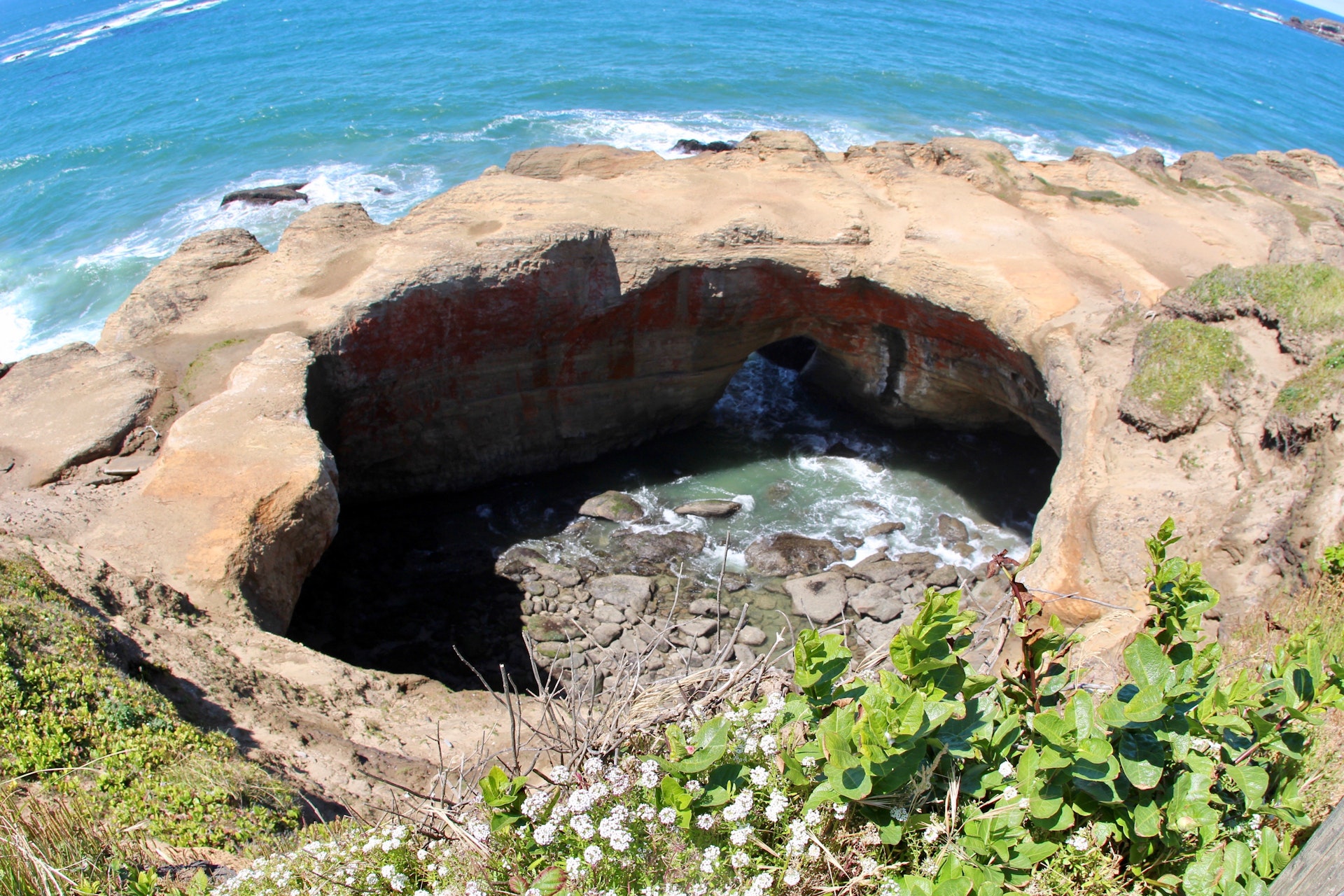
Surfers and surf watchers energize this area! During winter storms, water from the restless ocean slams with a thundering roar into a hollow rock formation shaped like a huge punch bowl. The surf churns, foams, and swirls as it mixes a violent brew. The punch bowl was probably created by the collapse of the roof over two sea caves, then shaped by wave action. The park is a popular whale watching site and displays an intriguing geology. This is a scenic picnic spot atop the undulating rocky shoreline. Don?t forget to explore the tidepools.
History of the Area
Located on the central Oregon coast, this unique geological formation and surrounding area has a rich history. The site is believed to have been formed around 18-20 million years ago due to volcanic activity that led to layers of sandstone and siltstone being deposited in the region.

Over time, these deposits were shaped by erosion from wind and water into what we see today - an impressive bowl-like structure with rugged cliffs overlooking turbulent waters below. This natural amphitheater was named for its resemblance to a large punchbowl.

The land became public property when it was acquired by Lincoln County through tax foreclosure proceedings during the Great Depression era (1930s). It remained under county jurisdiction until 1973 when management responsibilities transferred over to Oregon Parks & Recreation Department following legislation passed earlier that year which aimed at preserving important coastal sites across state lines.

Since then, numerous improvements have been made including construction of viewing platforms providing visitors panoramic views of marine life such as seals or sea lions along with various bird species inhabiting nearby rocks; installation of interpretive signs explaining local flora/fauna plus geology behind how everything came about; establishment trails leading down beach where one can explore tide pools teeming with aquatic creatures like starfish or mussels while also getting closer look inside actual "punchbowl".


Location
Devil''s Punchbowl Natural Area is located near Altadena, La Canada Flintridge and Littlerock


Visitor Comments, Memories and Reviews
write a review
Share On

Nearby Hotels
Booking.com

Directions
1. Start by heading west on Highway 20 from Newport or east if coming from Lincoln City.
2. After approximately 8 miles (13 kilometers), you will see signs for "Devil's Punchbowl State Park." Take a right onto NE Rocky Creek Road.
3. Continue driving along NE Rocky Creek Road for about half a mile until you reach the parking area at Devil's Punchbowl.

state route ranger badge
Oregon
26

Oregon State Parks

X