CUMMINS FALLS
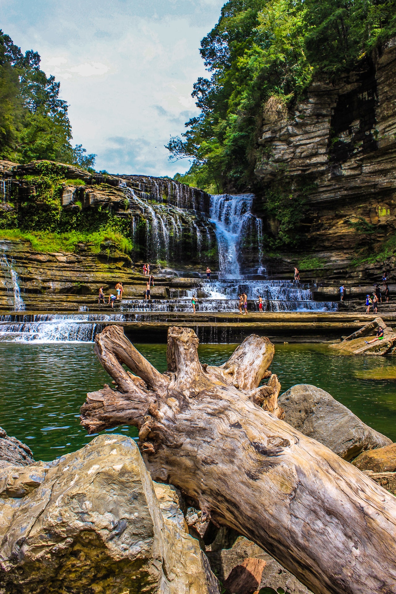
Located on the beautiful Blackburn Fork State Scenic River, this idyllic 211-acre site in Jackson County is home to Tennessees eighth largest waterfall at 75 feet high. Cummins Falls is formed on the Eastern Highland Rim and has been a favorite scenic spot and swimming hole for residents of Jackson and Putnam counties for more than 100 years.
This park is located in the Cordell Hull Watershed. The forest that borders the river includes a variety of oaks, beech, buckeye, sycamore and hemlock. Woodland plants include Octobers lady tresses, star chickweed, liverleaf and Allegheny spurge. The propertys long forested streamside protects turkey, quail, eagles and other birds soft-shell and other turtles fox, mink, and myriad insects including damselflies and dragonflies.
Cummins Falls rich history includes a time when Indians used the area to track the numerous buffalo that wallowed in the rivers shallow areas. In the 1790s, Sergeant Blackburn, a veteran of the Revolutionary War and for whom the Blackburn Fork State Scenic River was named, was awarded the land in lieu of a pension. The land was acquired by John Cummins in 1825, and he used the land to build the first of two mills. Because of his growing clientele, a larger second mill was built in 1845. Local residents would visit the mills and the falls for both commerce and recreation.
The mill was washed away during the great flood of 1928, but cars and paved highways had already begun to make the trek to Cummins Falls more accessible. The land was not rebuilt, but stayed with the Cummins family for more than 180 years until efforts by the Tennessee Parks and Greenways Foundation to purchase the land through private and public donations for resale to the state of Tennessee.


 Share Your Cummins Falls Photos (click here)
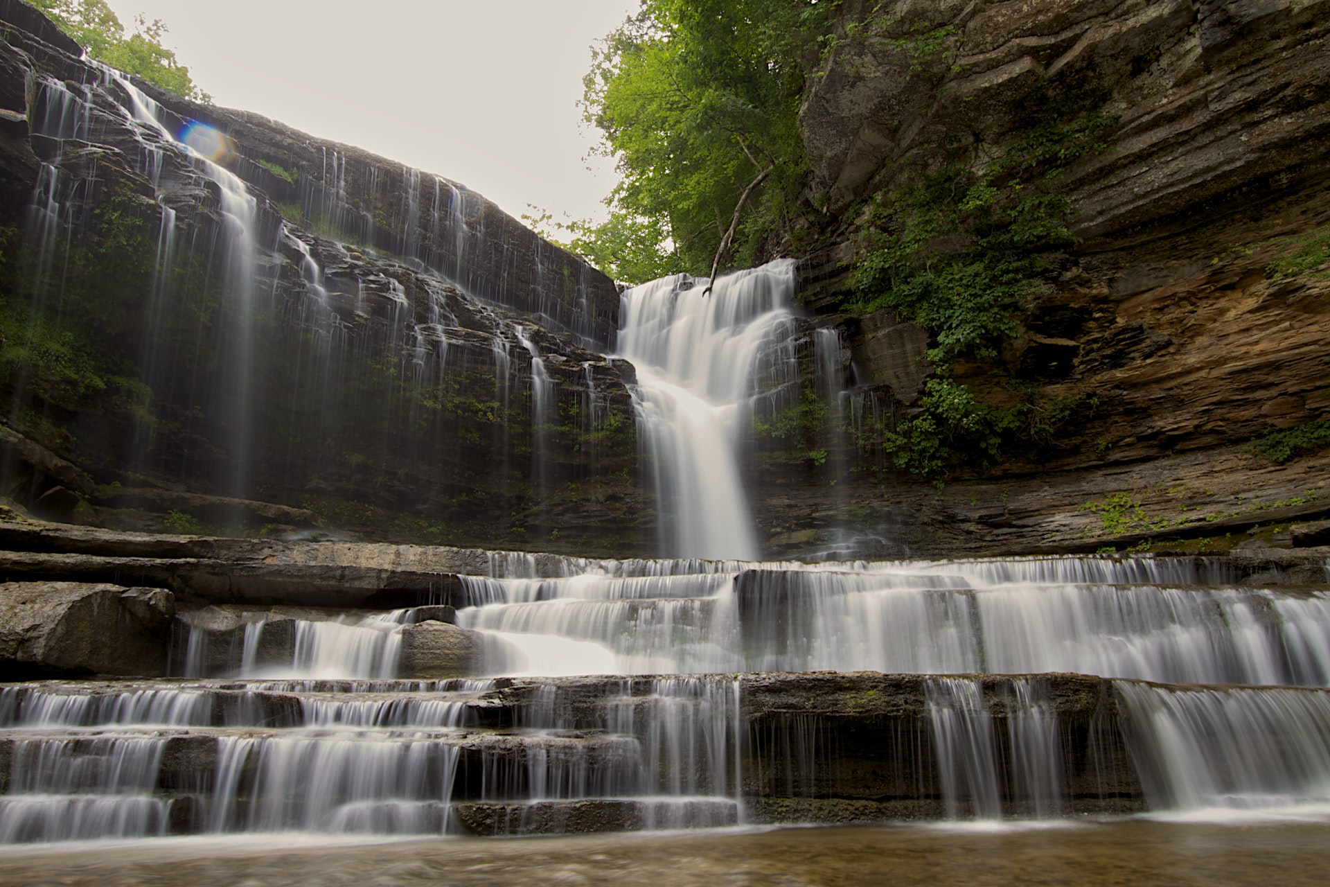