BEAVER DAM STATE PARK
Beaver Dam State Park is Eastern Nevada's most remote park, and is a popular area for hikers and nature enthusiasts who enjoy its primitive and rustic character. Deep canyons, pinion and juniper forests, a flowing stream and numerous beaver dams are the primary features, offering fishing, camping, picnicking, hiking, photography and nature study. Facilities include campgrounds, a group use area, a day-use picnic area, and hiking and interpretive trails. Beaver Dam is open year-round, weather permitting, but travel is not advised during winter months.
Situated in rugged canyon country, this 2,393-acre park is located approximately 34 miles east of Caliente adjacent to the Utah border. Motorists can reach the park by driving six miles north of Caliente on US 93, then 28 miles east on a graded gravel road that leads to the park entrance. The park sits at an elevation of 5,000 feet. Vehicles and trailers over 25 feet long are not recommended because of switchbacks on the road to the park.
Deep canyons, meandering streams, and diverse plant communities characterize the park's landscape. Volcanic rocks are dominant and include extrusive pink rhyolite, dark red and grey andesite's and white ash-fall tuff's. Vegetation varies from dense to sparse depending upon the microclimate, soil cover, topography, and other physical conditions. Dominant plants include pinion-juniper woodlands, ponderosa pines, sage brush, Gambel oak, willow and cottonwoods, and several varieties of cactus. The native wildlife at Beaver Dam is also diverse. Common animals include beaver (who actually build dams along the stream), mule deer, rabbits, bull frogs, a variety of birds, bats, rodents, lizards, and snakes. The Nevada Division of Wildlife stocks Beaver Dam wash with rainbow trout. Desert suckers and golden shiner fish are also locally abundant.
Indians first explored this area, camping and hunting along the streams of Headwaters Creek and Pine Creek. The streams join to form Beaver Dam Wash above the reservoir. Spaniards may have also crossed the region between 1540 and 1775 while establishing trade routes in the Southwest. In 1849, a group of emigrants left the established old Spanish trail to the south on their way to seek gold in California.
In hospitable weather and terrain forced them to abandon their wagons on the east rim of Pine Park Canyon. They proceeded on foot with their horses and mules but before leaving the area, two men, Wesley Smith and Henry W. Bigler (who later became governor of California) engraved their initials in a cliff: "WHB, Saturday, Nov. 3, 1849". The first to homestead the area was the Hamblin family during the 1860s. Today only remains of an early 1930s railroad tie house and wooden corral are visible. The reservoir and dam existed from 1961 until 2005 when record floods overtopped the dam and destabilized it. It was breached by Nevada Department of Wildlife out of public safety concerns in April 2005. Currently the area in around the old dam site is re-vegetating to its natural state. This is part of the environment history in this area, as the original campgrounds established by the Civilian Conservation Corps (CCC) were washed away and replaced with the current campgrounds now in use.
Interest in the park began in 1917 when residents of Clover Valley (now Barclay) would visit the Hamblin Ranch (near the present western park boundary) for a day or two outing. The 1935 State Legislature designated Beaver Dam as a state park due to the insistence and support of local residents and state officials. Exceptional scenery and the recreational possibilities of Beaver Dam Wash were primary considerations in the park's designation. Camping facilities were constructed by the Civilian Conservation Corps (CCC) from 1934-36. No other improvements were made until August 1961 when the dam was completed, creating the reservoir that provides flood control and enhanced fishing opportunities. Dedicated in 1962, the 15-acre reservoir was named for George Schroeder, an engineer who suffered a heart attack at the construction site.
Three developed campgrounds offer 33 individual campsites, each containing a fire pit, picnic table and parking pad, some suitable for trailers up to 20 feet in length. Camping is on a first-come, first-served basis. Water hydrants and vault or chemical toilets (no flush facilities) are conveniently scattered throughout the park. Water is available from May - October with fees charged year-round.


 Share Your Beaver Dam State Park Photos (click here)
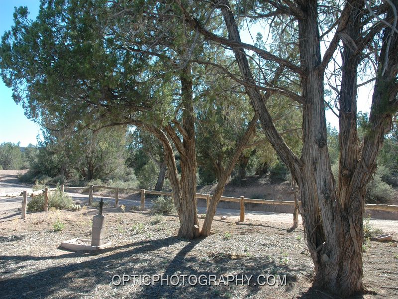