SWALLOW FALLS STATE PARK
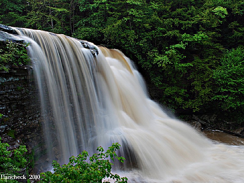
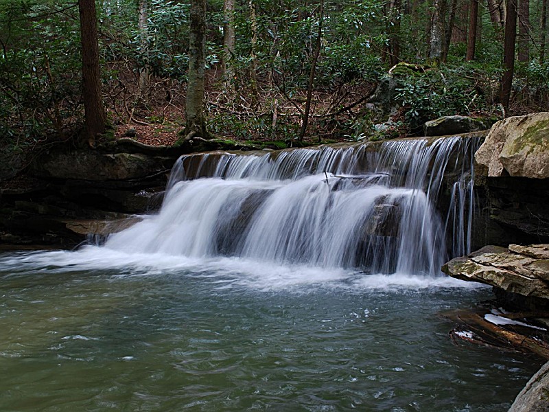
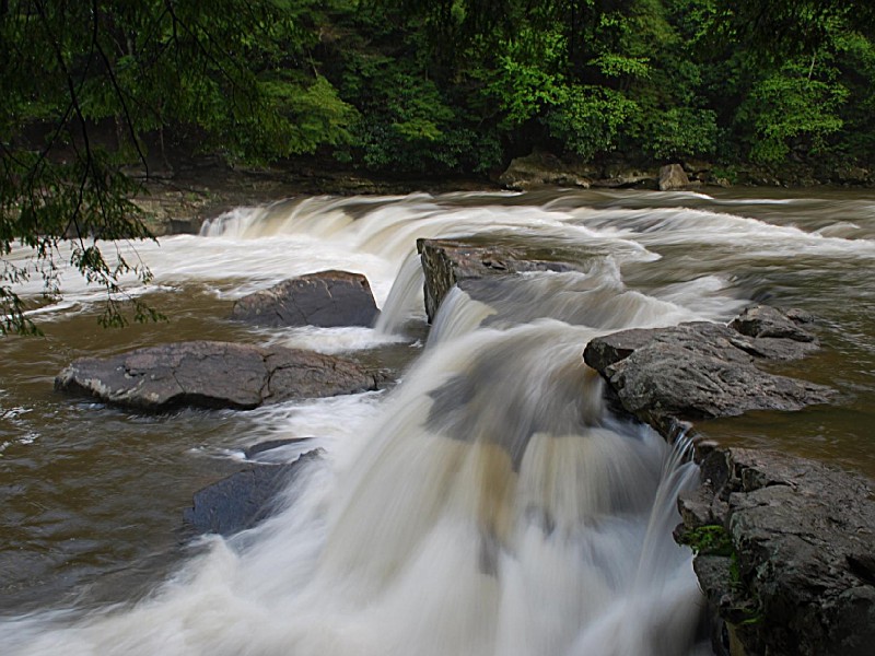
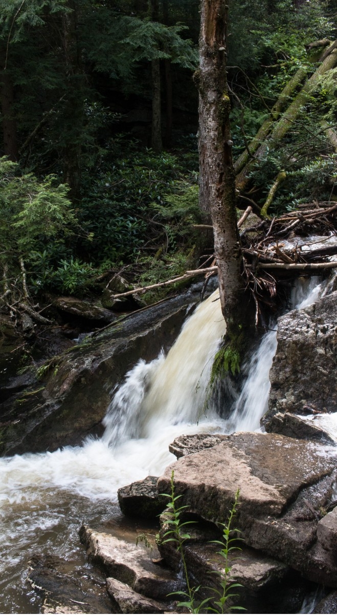
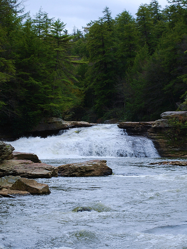
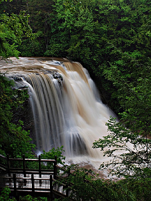
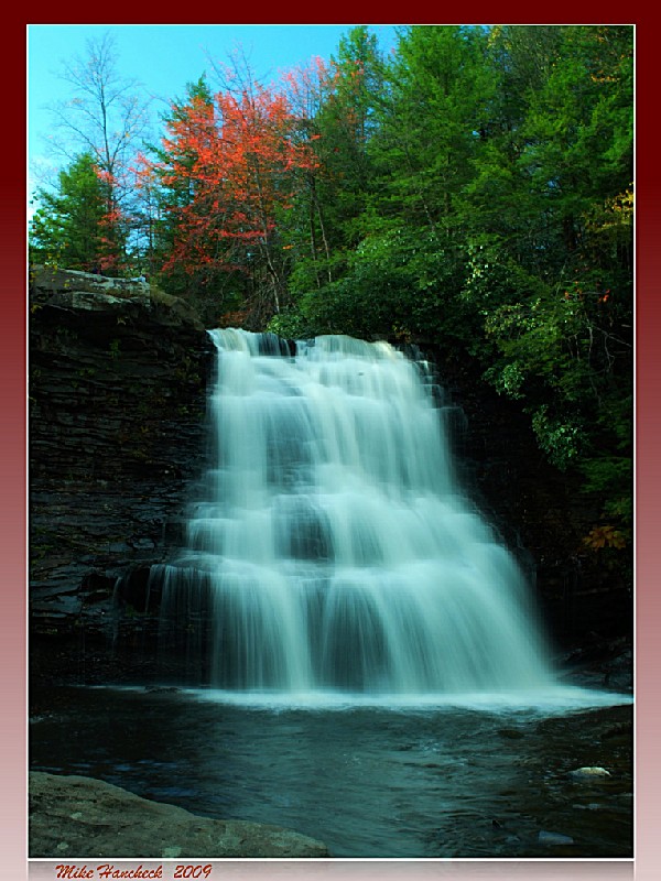
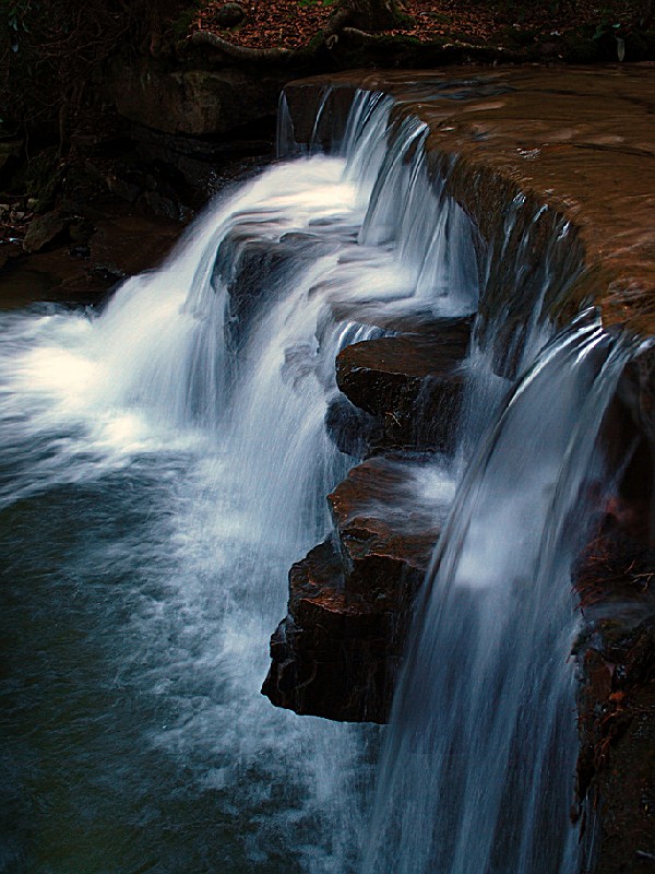
This mountain park is located nine miles north of Oakland, Maryland contains some of Maryland's most breathtaking scenery. The Youghiogheny River flows along the park's borders, passing through shaded rocky gorges and creating rippling rapids. Muddy Creek Falls is a crashing 63-foot waterfall – a spectacular sight. Tall hemlocks dominate the silent woods. The meandering trails through Swallow Falls guide hikers to some of the most breath-taking scenery in Western Maryland. This is a Maryland State Park. For full information go to the official webpage. (Link on the right side)
Day-UseFishingyes
Hiking Trailyes
Picnickingyes
Swimming Beachyes
Bike Trailsyes
BoatingLaunch Rampsyes
WinterActivitiesyes
Cottages and Cabins
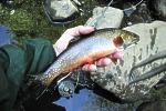
For those who like to fish for wild trout...this is the place to be Savage River Outfitters is a full line Orvis Dealer and Fly Shop with vacation rentals located on the Savage River in Western Maryland. Call ahead to book a half or full day wade trip or fly fishing instructions.
15.2 miles from park*
Anglers can enjoy river fishing in the Youghiogheny River. Species include smallmouth bass, trout and walleye. A valid Maryland license is required.
Swallow Falls State Park is located near Oakland
Swallow Falls State Park offers picnic tables, grills and pavilions. Picnic areas have beautiful views of the waterfalls and forest.
Fishing
For those who like to fish for wild trout...this is the place to be Savage River Outfitters is a full line Orvis Dealer and Fly Shop with vacation rentals located on the Savage River in Western Maryland. Call ahead to book a half or full day wade trip or fly fishing instructions.
15.2 miles from park*
* From Baltimore: 3 ? hours From Route 70 west to Hancock, Maryland and Rt. 68. Follow Rt. 68 west to exit 14 at Keysers Ridge and Rt. 219. Follow Rt. 219 south 19.5 miles to Mayhew Inn Road (2 miles past Deep Creek). Turn right on Mayhew Inn Road, travel 4.5 miles to end of road. At the stop sign turn left onto Oakland Sang Run Road, travel 0.3 miles to first road on the right which will be Swallow Falls Road. Turn right onto Swallow Falls Road and travel 1.3 miles to Swallow Falls State Park, or 4.5 miles further to Herrington Manor State Park. * From Washington: 3 ? hours Follow Rt. 270 west to Frederick and Rt. 70. From Route 70 west to Hancock, Maryland and Rt. 68. Follow Rt. 68 west to exit 14 at Keysers Ridge and Rt. 219. Follow Rt. 219 south 19.5 miles to Mayhew Inn Road (2 miles past Deep Creek). Turn right on Mayhew Inn Road, travel 4.5 miles to end of road. At the stop sign turn left onto Oakland Sang Run Road, travel 0.3 miles to first road on the right which will be Swallow Falls Road. Turn right onto Swallow Falls Road and travel 1.3 miles to Swallow Falls State Park, or 4.5 miles further to Herrington Manor State Park. * From Morgantown, West Virginia: 2 hours Follow Rt. 68 east to exit 14 and Rt. 219. Follow Rt. 219 south 19.5 miles to Mayhew Inn Road (2 miles past Deep Creek). Turn right on Mayhew Inn Road, travel 4.5 miles to end of road. At the stop sign turn left onto Oakland Sang Run Road, travel 0.3 miles to first road on the right which will be Swallow Falls Road. Turn right onto Swallow Falls Road and travel 1.3 miles to Swallow Falls State Park, or 4.5 miles further to Herrington Manor State Park. * From Pittsburgh, Pennsylvania: 2 ? hours Follow Rt. 79 south to Morgantown, West Virginia and Rt. 68. Follow Rt. 68 east to exit 14 and Rt. 219. Follow Rt. 219 south 19.5 miles to Mayhew Inn Road (2 miles past Deep Creek). Turn right on Mayhew Inn Road, travel 4.5 miles to end of road. At the stop sign turn left onto Oakland Sang Run Road, travel 0.3 miles to first road on the right which will be Swallow Falls Road. Turn right onto Swallow Falls Road and travel 1.3 miles to Swallow Falls State Park, or 4.5 miles further to Herrington Manor State Park.


 Share Your Swallow Falls State Park Photos (click here)
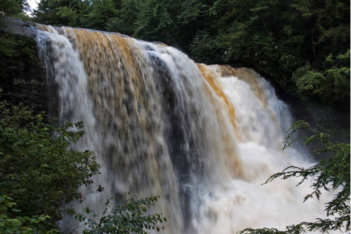