SALT POINT STATE PARK
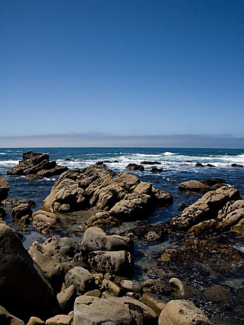
Rocky promontories, panoramic views, kelp-dotted coves, and the dramatic sounds of pounding surf; open grasslands, forested hills, pristine prairies, and pygmy forests- you can experience all of these coastal wonders within the Salt Point State Park. With 20 miles of hiking trails, over six miles of rugged coastline, and an underwater park, you can enjoy a variety of picnicking, hiking, horseback riding, fishing, skin and SCUBA diving, and camping. The weather can be changeable along the rugged Northern California Coast. Even summertime can be cool as fog hugs the coastline and ocean winds chill the air. We recommend layered clothing for your visit.
Sandstone and TafoniEver wonder where the streets of San Francisco came from? Sandstone from Salt Point was used in the construction of San Francisco's streets and buildings during the mid 1800's. If you look closely at the rocks at Gerstle Cove, you can still see eyebolts where the ships anchored while sandstone slabs were loaded onboard. Quarried rocks can still be seen scattered along the marine terrace north of Gerstle Cove. Look for the drill holes along the edges of the rocks that were used to separate the large rocks into smaller slabs.
Tafoni is the Italian word for cavern. It is a natural phenomenon that is common along the sandstone near the ocean's edge at Gerstle Cove and Fisk Mill. Look for a honeycomb type network carved into the rocks forming pits, knobs, ribs, and ridges.
Land Plants and Animals
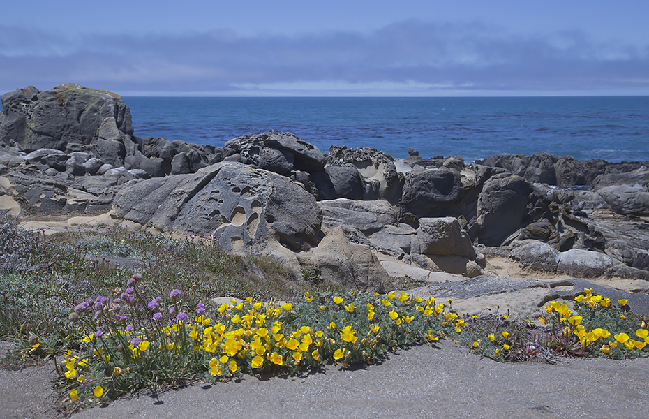
As the terrain rises northeast of Highway One, coastal brush and grasslands blend into lush growths of bishop pine, Douglas, fir, madrone, tan oak, groves of second growth redwood and quiet meadow areas. At the top of the coastal ridge, at about 1,000 feet elevation, there is a large open "prairie" where elk once grazed. At Salt point's highest elevation, you will find pygmy forests where stands of pygmy cypress, pine, and even the normally gigantic redwood grow only to stunted sizes. This is caused by the combination of a highly acidic soil that is lacking in nutrients and a hardpan layer just below the soil surface. Similar stands of pygmy forest are found all along the Pacific Coast from Monterey County northward to Mendocino County.
Black-tailed deer, raccoons, coyotes, bobcats, gray foxes, badgers, striped skunks, and dozens of varieties of rodents such as squirrels, chipmunks, and field mice are native to this area. Bears and mountain lions occasionally range the area, although visitors rarely see them.
The forest, grassland, and ocean's shore host a huge variety of birds. Look for pelicans, ospreys, woodpeckers (including pileated), and oyster catchers. Be wary of Steller's jays and ravens who ravage unattended campsites in search of food.Marine Plants and AnimalsBull kelp thrives along the Pacific coast. In April, no kelp is visible from the shore, but its growth has already begun. Attaching to rocks with a holdfast, it will grow up to 10 inches per day as it reaches for sunlight at the ocean's surface. In August, the water is dark with the lush kelp forest that provides homes for numerous varieties of rock fish and marine organisms.
Sonoma Coast is famous for its red abalone. This slow-growing aquatic snail is an important part of the intertidal community. It takes an abalone an average of 10 years to reach a diameter of 7 inches.
Gray whales can be seen between December and April as they migrate southward to their breeding and calving areas along the coast of Baja California and then return to their summer feeding areas in the Bering Sea.
Gerstle Cove is an Underwater Reserve where no form of marine life may be taken or disturbed. The boundaries are marked with a yellow pole on the north end and yellow paint on the south.
All campsites, with the exception of our overflow camping, are equipped with a fire-ring, picnic table, and food locker. The campgrounds have drinking water and restrooms but no showers. A dump station is not available.
FAMILY SITES
Two main campgrounds are available at Salt Point State Park. Gerstle Cove campground is situated atop the coastal bluffs on the ocean side of Highway One and offers 30 family campsites. Woodside Campground, with 79 sites, is located on the east side of Highway One.
WALK-IN SITES
The walk-in campground is located in the Woodside Campground and offers 20 sites which are located 1/3 to 1/2 mile from the parking area. Dogs are prohibited in these sites.
HIKER/BIKER SITES
Ten sites are available for campers on foot or bicycles. These sites are located behind the ranger office near Woodside Campground.
GROUP CAMPING
This camp is located on the ocean side of Highway One and accommodates a maximum of 40 people and ten cars. Dogs are prohibited.
OVERFLOW CAMPING
A day use parking lot located below Gerstle Campground is available for self-contained vehicles only. No tent camping or open fires are allowed. No restroom facilities or drinking water are available.


 Share Your Salt Point State Park Photos (click here)
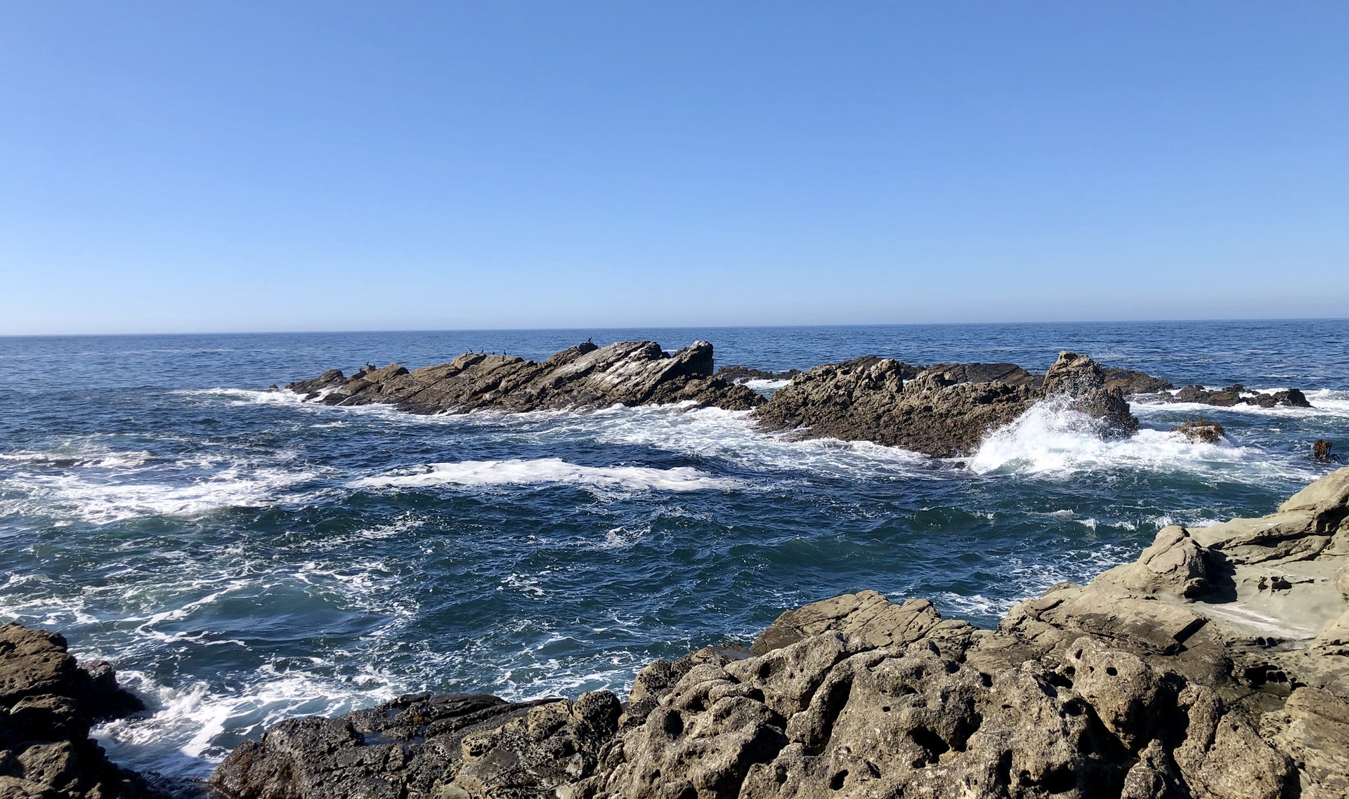