Save
You must be signed in to save park lists.
Your Park Lists
add New List
Add Photo
You must be signed in to add photos.
state route ranger badge
Connecticut
7

Connecticut State Parks

responsive menu icon
USA Parks
Connecticut
River Valley Region
Salmon River State Forest
Robin © stateparks.com
Campfire and Hotdogs © stateparks.com
Roasting hot dogs over an open fire.
Search
Availability
Calendars
Availability Search
SALMON RIVER STATE FOREST
Get a glimpse of earlier times as you walk through one of Connecticut's covered bridges. Enjoy a day of fishing and a picnic along the Salmon River.
History of the Area
The first purchase of lands which comprise the Salmon River Forest was made by the State Board of Fisheries and Game in 1934. The Forest now contains nearly 6,000 acres located in the towns of Hebron, Marlborough Colchester, East Haddam, and East Hampton. Included in the forest area is 1,300 acres that are leased from the United States Government.The important tributaries of the Salmon River are the Dickenson Stream, Blackledge River, Jeremy River, and Fawn Brook, all of which enter the main river above Comstock Bridge. The Salmon River joins the Connecticut River a short distance from East Haddam. It is probably the largest stream and watershed whose sources and mouth are entirely within the limits of the State.One of the early and notable settlers in this area was John Carrier who was reputed to be the executioner of Charles the First and who fled England when the monarchy was restored. His family name still exists on the land records of the area.The towns in this area were settled during the early part of 1700 and were typical of the early New England settlements. Streams and ponds were dammed to furnish waterpower for grist mills, tanneries, and later paper mills.The Salmon River and its tributaries each had more mills trying to operate by the middle of the nineteenth century than the water supply could support during periods of minimal precipitation. At North Westchester, for example, during low periods the grist mills had to operate at night and the paper mill by the day.The easy accessibility of the Salmon River and its tributaries has made the forest a very popular fishing area.
Passes
Connecticut has made state parks, forests, trails, historic sites and beaches more accessible to our residents so they can enjoy the many attractions and beauty they offer. Under the Passport to the Parks program, parking fees are now eliminated at Connecticut State Parks for those with Connecticut registered vehicles. You can view the CONNECTICUT PASSPORT TO THE PARKS web page to learn more.
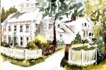
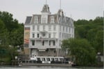
Nearby Accommodations
businesss listing main photo
BBs / Inns
Located along the CT Shoreline midway between New York City and Boston, and only one hour from Hartford, with tons of local attractions both on the Long Island Sound and the Connecticut River.
17.8 miles from park*
Nearby Vacation Rentals
Search for a vacation rental
Fishing
The first purchase of lands which comprise the Salmon River Forest was made by the State Board of Fisheries and Game in 1934. The Forest now contains nearly 6,000 acres located in the towns of Hebron, Marlborough Colchester, East Haddam, and East Hampton. Included in the forest area is 1,300 acres that are leased from the United States Government.

The important tributaries of the Salmon River are the Dickenson Stream, Blackledge River, Jeremy River, and Fawn Brook, all of which enter the main river above Comstock Bridge. The Salmon River joins the Connecticut River a short distance from East Haddam. It is probably the largest stream and watershed whose sources and mouth are entirely within the limits of the State.One of the early and notable settlers in this area was John Carrier who was reputed to be the executioner of Charles the First and who fled England when the monarchy was restored. His family name still exists on the land records of the area.

The towns in this area were settled during the early part of 1700 and were typical of the early New England settlements. Streams and ponds were dammed to furnish waterpower for grist mills, tanneries, and later paper mills.The Salmon River and its tributaries each had more mills trying to operate by the middle of the nineteenth century than the water supply could support during periods of minimal precipitation. At North Westchester, for example, during low periods the grist mills had to operate at night and the paper mill by the day.The easy accessibility of the Salmon River and its tributaries has made the forest a very popular fishing area.


Trails
1. Salmon River Trail: This is a 6-mile long trail that follows the scenic route along the banks of the Salmon River, offering beautiful views and opportunities for fishing.

2. Air Line State Park Trail: A longer hike at approximately 50 miles in length, this rail-trail offers stunning forest scenery with diverse wildlife sightings possible throughout your journey.

3. Day Pond Brook Falls Hike: An easy-to-moderate level hiking path leading to an enchanting waterfall within dense woods; it's about two miles round trip from start to finish.

4. Comstock Bridge Loop Trails: These are short trails around one mile each which offer picturesque river scenes and historic sites like old mills or bridges including Connecticut's oldest covered bridge - The Comstock Covered Bridge.

5. Grayville Falls Town Park Trails: Located on eastern side of state forest these trails lead you through lush greenery towards mesmerizing waterfalls making them perfect choice for nature lovers.

6. Arrigoni Nature Preserve Trails: Offering serene walks amidst wildflowers, wetlands & hardwood forests ; they also provide access points for canoeing/kayaking into salmon river.

7. Raymond Brook Marsh Wildlife Sanctuary: It has several interconnected looped paths providing hikers opportunity to explore variety of habitats ranging from marshes, meadows , woodlands etc.

8. Hemlock Ravine Natural Area Preserve: Known as home to some rare plant species its main attraction includes deep ravines filled with hemlocks trees creating unique microclimate conditions.

9. Tom Callinan Memorial Forest Walks: Named after famous folk singer who was instrumental in preserving local natural heritage these pathways take visitors across various historical landmarks while traversing mixed deciduous:coniferous woodland areas.

10. The Blue-blazed Shenipsit Trail: section passes through part of park giving panoramic view over surrounding landscape especially during fall season when leaves change their colors adding extra charm.
Things To Do in the Area
businesss listing main photo
Boating
Explore the Connecticut River aboard the R/V River Quest, an environmentally friendly 64', 60 passenger vessel docked at Eagle Landing State Park, Haddam, CT.
14.1 miles from park*

Visitor Comments, Memories and Reviews
April 27 Beautiful area for all kinds of activity by Ed popham
park review stars; one to five
March 26 Good Hike
park review stars; one to five You begin hike by crossing the historic comstock bridge. You follow a trail that leads you along the river where you might run into some fisherman. The trail then takes you up hill out of the river valley. It would be considered an easy uphill, nothing that steep. The trails will lead you through some new england woods. You can take a the blue trail which will lead you to Day Pond state park. Not sure what the total mileage is but it is under 5 miles. from the point you park your car unitl you return. Have a good hike. Salmon river offers good trout fishing as well for any of you anglers out there. There is a fly fishing only zone marked by signs.
write a review
Share On

Area Campgrounds
Nelson's Family Campground
71 Mott Hill Road
East Hampton, CT
860-267-5300
Nelson's Family Campground
71 Mott Hill Road
E. Hampton, CT
Wolf's Den Campground
256 Town Street
East Haddam, CT
860-873-9681
Markham Meadows Campground
7 Markham Road
East Hampton, CT
860-267-9738
Lake Williams Campground
1742 Exeter Road Route 207
Lebanon, CT
860-642-7761
Water's Edge Family Campground
271 Leonard Bridge Road
Lebanon, CT
Indianfield Campground
306 Old Calchester Road
Salem, CT
860-859-1320
Salem Farms Campground
39 Alexander Road
Salem, CT
860-859-2320
Witch Meadow Lake Campground
139 Witch Meadow Road
Salem, CT
860-859-1542

Directions
From the Norwich area: take Route 2 west, Exit 18. Follow Route 16 west for 6.2 miles; turn left into the recreation area.

From the New London area: follow Route 11 north onto Route 2 west, Exit 18. Follow Route 16 west for 6.2 miles. Turn left into the recreation area.

From the Middletown area: follow Route 66 east onto Route 16. Follow Route 16 east for 5.5 miles. Turn right into recreation area.

From the Hartford area: take Route 2 east, Exit 16. Follow Route 149 south for 3.2 miles. Turn right onto Route 16 west. Follow Route 16 west for 1.9 miles. Turn left into the recreation area.

state route ranger badge
Connecticut
7

Connecticut State Parks

X