PORT CRESCENT STATE PARK
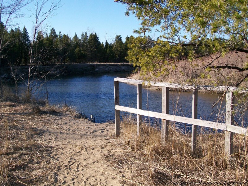
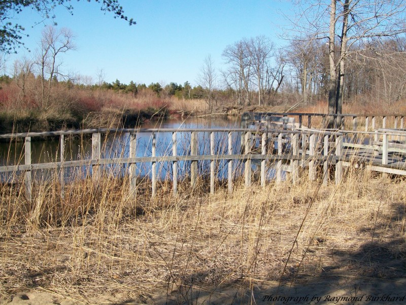
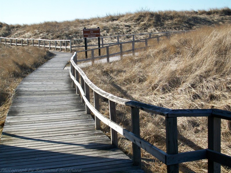
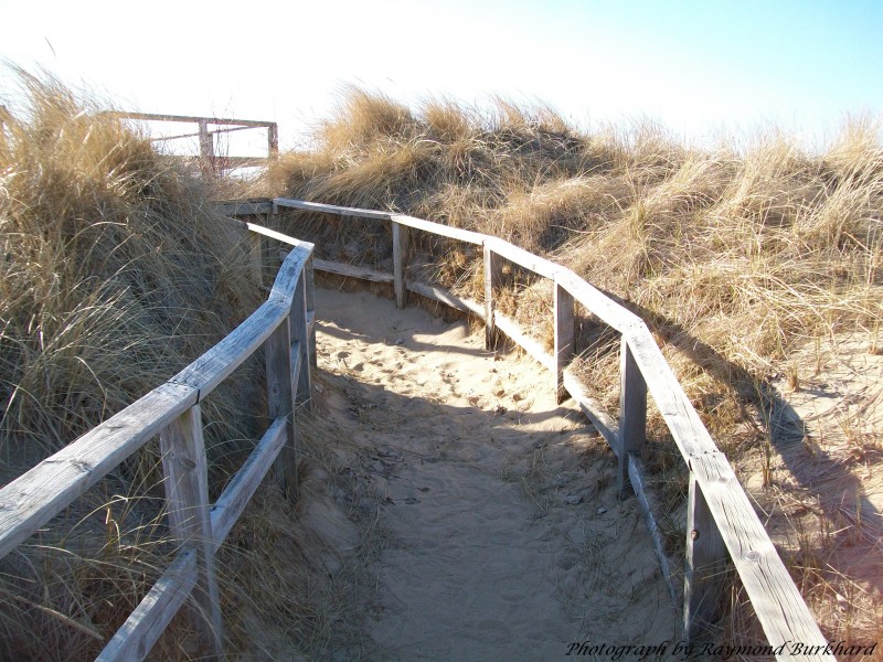
Port Crescent State Park is located at the tip of Michigan's "thumb" along three miles of sandy shoreline of Lake Huron's Saginaw Bay. Some of the modern campsites offer a waterfront view, either of the Bay or the Old Pinnebog River channel. A 900-foot boardwalk and five picnic decks offer scenic vistas from the top of sand dunes in the day-use area.
The Recreation Passport is required for vehicle entry into state parks and recreation areas, state boat launches, state forest campgrounds and state trail parking lots. Details and information on how to obtain your Michigan Recreation Passport can be found by visiting the
MICHIGAN RECREATION PASSPORT web page.
Port Crescent Camper Cabin(800) 447-2757 1 site(s)Barrier-free Facilities, Electrical Service, Modern Restrooms,
Sandy Beach Port Crescent-Modern(800) 447-2757 137 site(sElectrical Service, Mini Cabin, Modern Restrooms
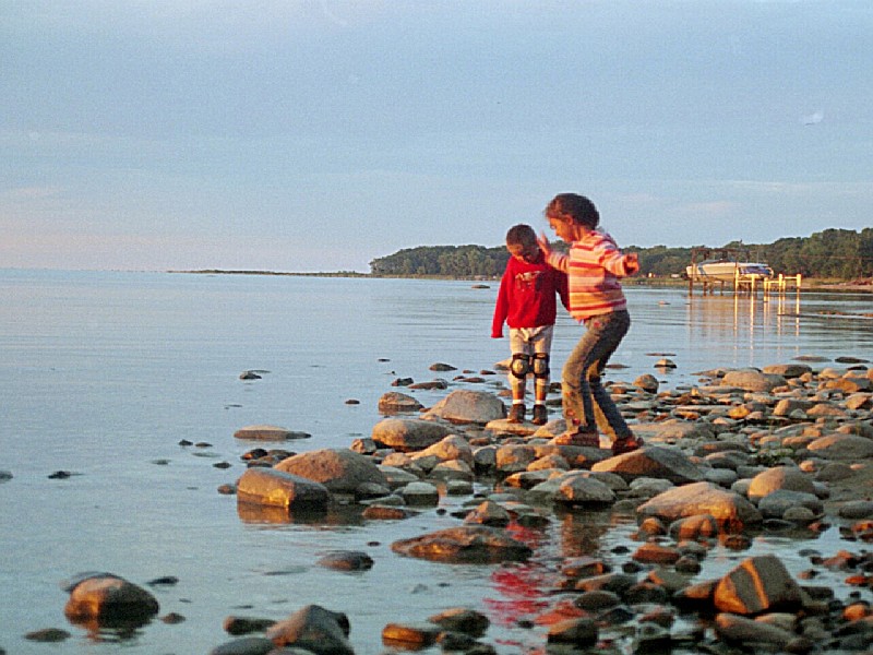
1. Port Crescent State Park offers a sandy beach for swimming on the shores of Lake Huron.
2. Lifeguards are not provided, so swim at your own risk.
3. The park's day-use area has modern restrooms and changing facilities near the beach.
4. Swimming is allowed during daylight hours only in designated areas marked with buoys to ensure safety.
5. There are no indoor or heated pools; all swimming options involve natural bodies of water within the park boundaries.
6. The lake's temperature varies throughout summer but can be quite refreshing even on hot days.
Boating enthusiasts have several options available within this park. There is a canoe/kayak launch site on the Pinnebog River, providing easy access to water for paddling adventures. Motorized boating isn't allowed in the river but there's plenty of space for rowboats and paddleboards too. Fishing boats can be launched from nearby Port Austin harbor into Lake Huron where motorized vessels are permitted.
A universally accessible fishing deck is available at the day-use area along the Pinnebog River.
Port Crescent State Park is
Port Crescent State Park offers picnic areas with tables and grills. There's also a pavilion available for larger gatherings.
Several trails totaling seven miles meander through various areas of the park.
Trails in the park:
Port Crescent-Fitness Trail - 1 (Miles), Hiking, Cross Country Ski
Port Crescent-Day Use Trail - 3.5 (Miles), Hiking, Cross Country Ski
Port Crescent-Organization Area Trail - 2.5 (Miles), Hiking, Cross Country Ski
While exploring the park, one can enjoy a 2.3-mile paved bicycle route that offers scenic views of nature.
The bike trail is suitable for all skill levels and provides an excellent opportunity to observe wildlife in their natural habitat.
However, it's important to note that there are no dedicated biking trails within this area; cyclists share paths with pedestrians.
Cyclists should be aware of potential hazards such as loose sand or gravel on pathways which could lead to accidents if not careful.
Remember also that helmets are strongly recommended while cycling here due to safety reasons.
It's advised you bring your own bicycles since rental services aren't available inside the park boundaries.
During peak seasons like summer, expect more foot traffic along these shared routes so exercise caution when riding around others.
Lastly, always respect local regulations regarding where bikes may go - stick only designated areas and avoid off-trail rides for preservation purposes.
Birdwatchers can enjoy spotting a variety of species, including waterfowl and songbirds. The park's diverse habitats attract numerous birds throughout the year. There are also opportunities to see migrating raptors in spring and fall seasons. Birding trails offer excellent viewing points for enthusiasts.
N. on M-53 (VanDyke) from the Detroit area. 17 miles N. of Bad Axe. Or, I-75 to Bay City exit at M-25. 65 miles N.E. of Bay City. Park is located on M-25, 5 miles S.W. of Port Austin.


 Share Your Port Crescent State Park Photos (click here)