MOUNT TAMALPAIS STATE PARK
Just north of San Francisco's Golden Gate is Mount Tamalpais. It has redwood groves and oak woodlands with a spectacular view from the 2,571-foot peak.
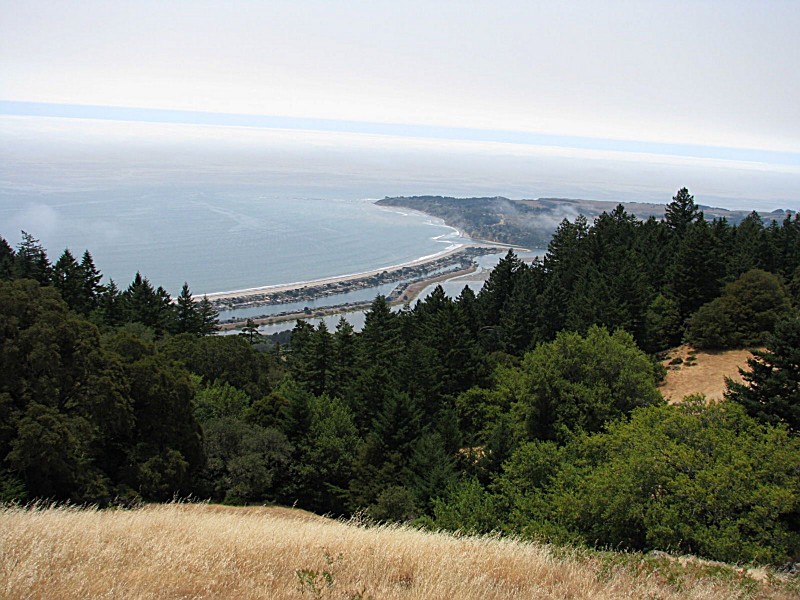
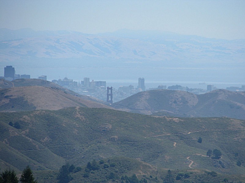
On a clear day, visitors can see the Farallon Islands 25 miles out to sea, the Marin County hills, San Francisco and the bay, hills and cities of the East Bay, and Mount Diablo. On rare occasions, the Sierra Nevada's snow-covered mountains can be seen 150 miles away.
Coastal Miwok Indians lived in the area for thousands of years before Europeans arrived. In 1770, two explorers named the mountain La Sierra de Nuestro Padre de San Francisco, which was later changed to the Miwok word Tamalpais.
With the Gold Rush of 1849, San Francisco grew and more people began to use Mount Tamalpais for recreation. Trails were developed and a wagon road was built. Later, a railway was completed and became known as "The Crookedest Railroad in the World." It was abandoned in 1930 after a wildfire damaged the line.
Mount Tamalpais State Park is located near Alameda, Albany and Belvedere Tiburon
The park has the Bootjack Picnic Area with tables, stoves, piped drinking water and flush toilets.
Railroad Grade, Fern Creek Trails
From Mountain Home Inn to East Peak summit is 6 miles round tripwith 1,300-foot elevation gainFor more than century, Bay Area walkers and visitors from around the world have enjoyed rambling the slopes of Mount Tamalpais. Glorious panoramas of the Pacific coastline and San Francisco Bay were attracting walkers to the mountaintop well before Mt. Tam was preserved as a state park in 1928.
If you?re lucky, perhaps you?ll experience what some Bay Area walkers call ?a Farallons Day??one of those clear days when visibility is greater than 25 miles, thus allowing a glimpse of the sharp peaks of the Farallon Islands.
The Mt. Tamalpais and Muir Woods Railroad, known as ?the crookedest railroad in the world,? was constructed in 1896; it brought passengers from Mill Valley to the summit via 281 curves. Atop Mt. Tam, the Tavern of Tamalpais welcomed diners and dancers.
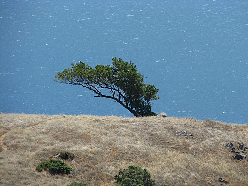
Redwood-lined creeks, stands of Douglas fir, and oak-dotted potreros are just a few of the great mountain?s delightful environments. Thanks to the early trail-building efforts of the Tamalpais Conservation Club, as well as later efforts by the CCC during the 1930s, more than fifty miles of trail explore the state park. These trails connect to two hundred more miles of trail that lead through the wooded watershed of the Marin Municipal Water District, and over to Muir Woods National Monument and Golden Gate National Recreation Area.
Mt. Tam?s top, with its fire lookout tower ringed with barbed wire, itself isn?t quite as nice as the top-of-the-world views it offers. Motorists can drive to within 0.3 mile to the top, which often means a crowd at the summit.
Ah, but getting there is more than half the fun, particularly on trails like Railroad Grade and Fern Creek, which offer a little bit of everything: dense stands of laurel, open grassland, oak-dotted knolls, a canyon full of redwoods and ferns.
If you want to stay on the Railroad Grade all the way to the top of Mt. Tam, add 2.5 miles to the ascent plus 2.5 miles to the descent.
Offers diverse habitats: redwood groves, oak woodlands, grasslands. Home to species like Northern Spotted Owls and Pileated Woodpeckers. Popular for springtime warbler migrations; varied thrushes also spotted. Coastal areas attract seabirds such as Brown Pelicans and Cormorants. Raptors including Red-tailed Hawks soar above ridges.
Visitors can hike trails or visit the Muir Woods National Monument within its boundaries for birdwatching opportunities.
High points provide vantage spots for observing raptor migration in fall.
Birders often use Rock Spring Trailhead as a starting point due to its habitat variety.
The park's elevation gradient influences avian diversity from sea level up to peaks.
Remember that sightings vary by season and weather conditions influence bird activity levels significantly
The East Peak Summit features a visitor center and a refreshment stand that are usually only open on weekends (during the summer, the refreshment stand is open daily). Phone, picnic tables and fully accessible restroom are also available.
The Mountain Theater (a.k.a. The Cushing Memorial Theater) in the park was constructed by the Civilian Conservation Corps in the 1930s. The natural-stone amphitheater seats 3,750 people and features the Mountain Play each spring, produced every year since 1913.
North of San Francisco's Golden Gate. From Highway 101 take Highway 1 to the Stinson Beach exit and follow signs up the mountain.


 Share Your Mount Tamalpais State Park Photos (click here)