MOUNT SAN JACINTO STATE PARK
The deeply weathered summit of Mount San Jacinto stands 10,804 feet above sea level, the highest point in the San Jacinto Range and second highest in Southern California. No more than a two hour drive from either Los Angeles or San Diego, the mountain's magnificent granite peaks, subalpine forests, and fern-bordered mountain meadows offer a unique opportunity to explore and enjoy a scenic, high-country wilderness area. The park offers two drive-in campgrounds near the town of Idyllwild. Most of the park is a designated wilderness area enjoyed by hikers and backpackers.
Palm Springs Aerial Tramway:
Starting in Chino Canyon near Palm Springs, the tram takes passengers from Valley Station at 2,643 feet elevation to Mountain Station on the edge of the wilderness, elevation 8,516 feet. The Mountain Station features a restaurant, gift shop, snack bar, and the state park visitor center. In Long Valley, a short walk from the station, you will find the Long Valley Ranger Station, a picnic area with barbecue stoves and restrooms, a ski center, a self-guiding nature trail, and Desert View Trail which offers panoramas of the high country including several peaks over 10,000 feet in elevation. You can also enter the hiking trail system from this point. The tram operates year-round, except for a maintenance closure in August.
Day-UseFishingyes
Hiking Trailyes
Mount San Jacinto State Park is located near Banning, Beaumont and Cathedral City
Mount San Jacinto State Park offers scenic picnic areas with tables, grills available at Idyllwild and Stone Creek campgrounds. Enjoy alpine views while dining outdoors; pack in your food and pack out trash to preserve nature's beauty. Accessible by hiking or the Palm Springs Aerial Tramway for a unique experience above the clouds.
Pacific Crest Trail
The Pacific Crest Trail is the jewel in the crown of America?s scenic trails, spanning 2,650 miles from Mexico to Canada through three western states. The trail passes through five California State Parks: Castle Crags and McArthur-Burney Falls in Northern California; and Silverwood Lake, Anza Borrego Desert and Mt San Jacinto in Southern California.
San Jacinto Peak Trail
From Mountain Station to Round Valley is 4 miles round tripwith 600-foot elevation gain; to San Jacinto Peak is 11 miles round tripwith 2,300-foot elevation gain
The San Jacinto Mountain range is one of those magical places that lures hikers back year after year. Hikers enjoy the contrasts this range offers?the feeling of hiking in Switzerland while gazing down at the Sahara.
Palm Springs Aerial Tramway makes it easy for hikers to enter Mount San Jacinto State Wilderness. Starting in Chino Canyon near Palm Springs, a modern tram with rotating floors takes passengers from 2,643-foot Valley Station, the lower Tramway Terminal, to the Mountain Station, the 8,516-foot upper tramway terminal at the edge of the wilderness.
The day hiker accustomed to remote trailheads may find it a bit bizarre to enter Valley Station and find excited tourists shopping for souvenirs. But the tramcar rapidly leaves terra firma behind. Too rapidly, you think. It carries you over one of the most abrupt mountain faces in the world, over cliffs only a bighorn sheep can scale, over several life zones from palms to pines. When you disembark at Mountain Station, your ears will pop and you?ll have quite a head start up Mount San Jacinto.
The wild areas in the San Jacinto Mountains are administered by both California State Parks and United States Forest Service rangers. The middle of the region, including San Jacinto Peak, is part of the state park; most of it is managed as a wilderness area. On both sides of the peak, north and south, the wilderness is part of the San Bernardino National Forest. The entire area is within the Santa Rosa and San Jacinto Mountains National Monument.
The meadows and High Sierra-like scenery can be glimpsed on a moderate hike to Round Valley; the ascent through the lodgepole pine forest to the top of Mt. San Jacinto is absolutely splendid, as are the views from the peak.
Directions to trailhead: From Interstate 10, exit on California Hwy 111 (the road to Palm Springs). Proceed nine miles to Tramway Road, turn right, and follow the road 3.5 miles to its end at Valley Station. Contact the Palm Springs Aerial Tramway office for information about prices and schedules.
The hike: From Mountain Station, walk down the cement walkway through the Long Valley Picnic Area to the Long Valley Ranger Station. Obtain a day use wilderness permit here.
Continue west on the trail, following the signs to Round Valley. The trail parallels Long Valley Creek through a mixed forest of pine and white fir, then climbs into lodgepole pine country. Lupine, monkeyflower, scarlet bugler and Indian paintbrush are some of the wildflowers that add seasonal splashes of color.
After passing a junction with a trail leading toward Willow Creek, another 0.3 mile of hiking brings you to Round Valley. There?s a primitive campground and a backcountry ranger station in the valley, and splendid places to picnic near the meadow or among the towering pines.
An alternative to returning the same way is to retrace your steps 0.3 mile back to the junction with the Willow Creek Trail, take this trail a mile through the pines to another signed trail north back to Long Valley Ranger Station. This alternative route adds only about a 0.25 mile to your day hike, and allows you to make a loop.
Palm Springs Aerial Tramway
Starting in Chino Canyon near Palm Springs, the tram takes passengers from Valley Station at 2,643 feet elevation to Mountain Station on the edge of the wilderness, elevation 8,516 feet. The Mountain Station features a restaurant, gift shop, snack bar, and the state park visitor center. In Long Valley, a short walk from the station, you will find the Long Valley Ranger Station, a picnic area with barbecue stoves and restrooms, a ski center, a self-guiding nature trail, and Desert View Trail which offers panoramas of the high country including several peaks over 10,000 feet in elevation. You can also enter the hiking trail system from this point. The tram operates year-round, except for a maintenance closure in August.
Location-Directions From Riverside, take Interstate 10 East to Hwy 243 South to the park. From San Diego, take Interstate 15 North to 215 North, exit Hwy 74 east to Hwy 243 north to the park.


 Share Your Mount San Jacinto State Park Photos (click here)
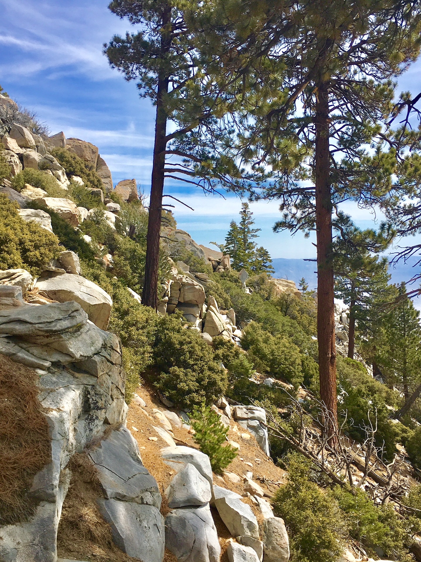