LAKE SUPERIOR STATE FOREST
LAKE SUPERIOR STATE FOREST
18 sites for tent and small trailer use. Located on the shore of Lake Superior known for excellent agate hunting along the beach. Rustic campground includes vault toilets and potable water from well hand pump. Sites available on a first-come, first-serve basis. No reservations. Check with State Forest Campground Manager for seasonal availability.
The history of the Lake Superior State Forest dates back to the late 19th century when the state of Michigan began acquiring land for forestry purposes. The primary aim was to conserve and manage the natural resources found in the region.
In the 1870s, the state legislature realized the importance of preserving the large forests of northern Michigan, including the area surrounding Lake Superior. This led to the establishment of the Michigan Department of Conservation in 1929, which was responsible for the management of the state's forested lands.
Over the years, the Lake Superior State Forest has evolved through various land acquisitions, management strategies, and changes in administrative agencies. The forest covers an area of about 1.3 million acres, encompassing multiple counties along Lake Superior's shore.
One significant event in the history of the Lake Superior State Forest was the development of a fire protection system. In the early 20th century, wildfires were a major concern, and the state took measures to prevent and control forest fires. Fire towers were constructed, firebreaks were established, and firefighting resources were improved.
In addition to fire protection, the Lake Superior State Forest has been actively managed for timber production. Sustainable forestry practices have been implemented to ensure the long-term health and productivity of the forest. This includes selective harvesting, reforestation efforts, and the promotion of diverse wildlife habitats.
The forest's scenic beauty and recreational opportunities have also attracted visitors and played a role in its management. The state of Michigan encourages outdoor activities like hunting, fishing, hiking, and camping in the Lake Superior State Forest. These activities help support local economies and provide opportunities for people to connect with nature.
The Lake Superior State Forest continues to be an important natural resource in Michigan. It contributes to the state's timber industry, provides wildlife habitat, preserves biodiversity, and offers recreational opportunities for residents and tourists alike. The forest's rich history and ongoing management efforts ensure its continued importance and sustainability for future generations.
The Recreation Passport is required for vehicle entry into state parks and recreation areas, state boat launches, state forest campgrounds and state trail parking lots. Details and information on how to obtain your Michigan Recreation Passport can be found by visiting the
MICHIGAN RECREATION PASSPORT web page.
1. Lake Superior State Forest Campground: This campground offers 50 campsites with picnic tables, fire rings and vault toilets. It's located near the shores of Lake Superior, providing opportunities for swimming, fishing and boating.
2. Two Hearted River State Forest Campground: Located within the forest on a bluff overlooking the river mouth at lake superior; this rustic campground has sites available on a first-come-first-serve basis.
3. Muskallonge Lake State Park: Although not directly in the state forest area but close by to it is another great camping option offering modern facilities including electricity hookups as well as access to hiking trails & water activities like canoeing or kayaking.
4. High Bridge National Forest Dispersed Camping Area: For those who prefer more primitive style camping experience can opt for dispersed camping areas where you are allowed to camp anywhere outside developed recreation areas unless otherwise posted closed and/or "No Camping".
5. Brevort Lake Campgrounds: Offers both RV spots along with tent-only locations that come equipped with amenities such as grills/fire ring combo units,picnic table etc.
6. Carp River (Lake Michigan)State Forrest Camprgound: A smaller site ideal if looking out for quieter options.
7. Monocle lake camprgounds: Another good spot which also provides accessibility features.
Search for a vacation rental
Ramp access on Blind Sucker Flooding and at Muskallonge Lake State Park.
Pine Ridge Trail (2 mi. East): 49 miles of cycle/ATV trail. Connects to two-Heart Trail.
Two-Heart Trail (20 miles East): 36 miles of cycle/ATV trail.
Lake Superior (on site): Walleye, Pike, Perch, Bass, Musky, Bluegill.
Blind Sucker Flooding (1 miles South): Pike, Perch, Bluegill, Rock Bass.
Muskallonge Lake (6 miles East): Walleye, Pike, Perch, Bass, Musky, Bluegill.


 Share Your Lake Superior State Forest Photos (click here)
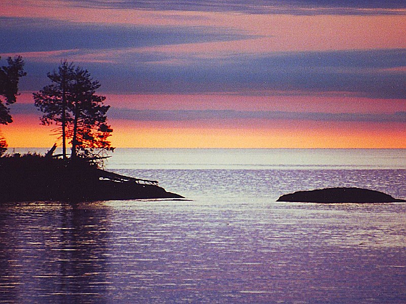