INKS LAKE STATE PARK
A dependable water source, abundant fish and game, and the areas natural beauty combined to make this an inviting location.
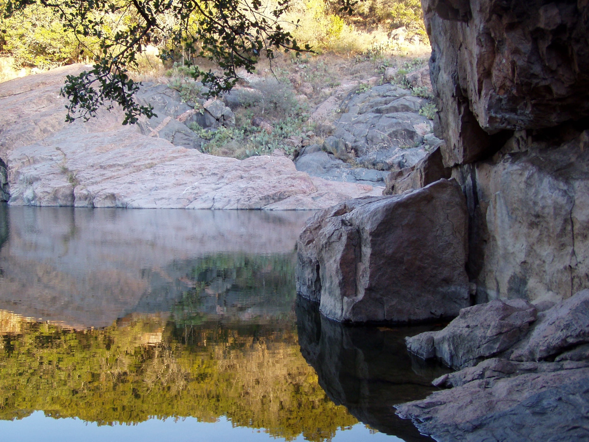
nks Lake State Park sits on the east edge of the Llano Uplift, the geologic heart of Texas. It has some of the best views of pre-Cambrian more than 600 million years old geology in the state.
The pink rock islands jutting up through the limestone in the park are metamorphic rock called Valley Spring gneiss nice. This gneiss is often mistaken for Town Mountain granite since they have similar color and texture. The small amount of granite in the park appears only as veins cutting through the gneiss.
Intense heat and pressure applied to the original rocks over millions of years formed gneiss. The original rocks were sedimentary formed from sand, silt and mud and igneous likely granite. Learn more on geology hikes offered throughout the year. Check the Events page for the next hike
The Colorado River is the largest river entirely within the state of Texas. It travels 862 miles almost 600 billion gallons of water flow in a typical year. With the steep slopes and thin, rocky soils of the area, the river flooded frequently and with devastating results.
The river was as much a danger as a blessing for nearby residents.
The Lower Colorado River Authority built a series of six dams to help control the river. Inks Lake is second lake in the series. Two dams form its boundaries Buchanan Dan to the north and Inks Dam to the south.
Dam construction provided needed work for local farmers and ranchers at the height of the Great Depression.
As part of the Colorado River improvements, the state legislature ordered the creation of a park on the new lake. The state parks board acquired about 1,200 acres for Inks Lake State Park in 1940. The National Park Service planned the parks improvements, with construction by the Civilian Conservation Corps.
CCC Company 854 was already in the area. Work on Longhorn Cavern State Park had begun in 1932 and finished in October of 1940. The men had also built a scenic parkway, complete with bridges and culverts made of local materials, to connect that park to nearby roadways.
The company immediately began its next assignment building facilities at Inks Lake State Park and extending the scenic parkway from Longhorn Cavern to Inks Lake.
With the approach of World War II, funding for the CCC dried up, and the Inks Lake CCC camp was abandoned 1942. Only remnants of their work remain in the park today.
The State Parks Board oversaw final construction of the park, and it opened in 1950.
1. Inks Lake State Park offers a designated swimming area in the lake.
2. No lifeguards are on duty, so swim at your own risk.
3. Swimming is allowed all year round due to constant water levels and temperatures.
4. The park also provides opportunities for snorkeling with clear visibility underwater.
5. The Devil's Waterhole is another popular spot within the park where visitors can cliff jump into deeper waters.
6. You may encounter local wildlife while swimming including fish, turtles and ducks.
Enjoy fishing from the pier or shore for species like catfish, bass and sunfish. Boating is also permitted.
Crappie, white bass and several types of perch are other fish you might catch.
Fishing gear can be borrowed on-site without any fees.
No license is required to fish from a bank or pier within park boundaries.
The lake's clear water makes it perfect for fly-fishing as well.


 Share Your Inks Lake State Park Photos (click here)
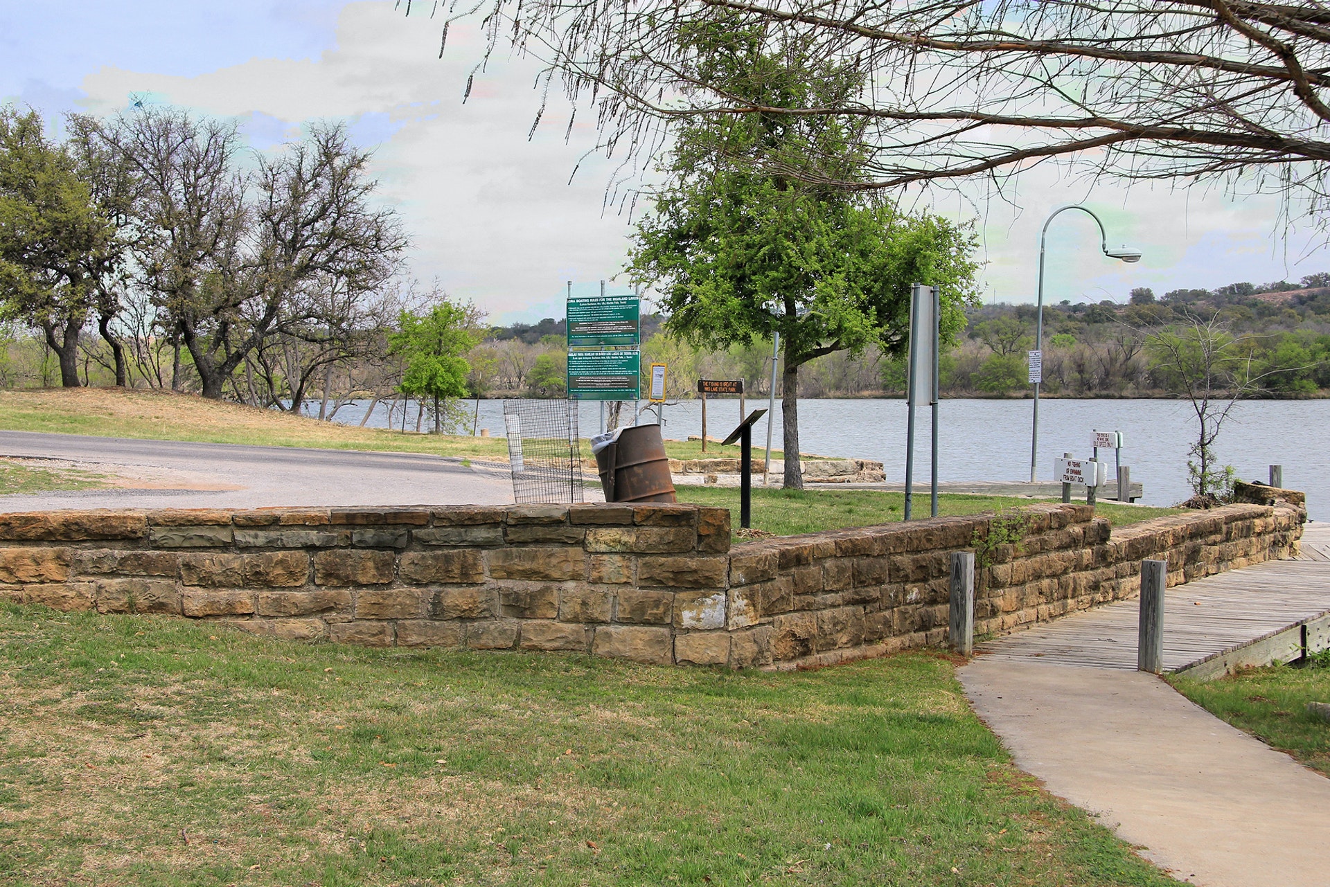